Key takeaways
- Aerial photo software transforms raw drone or scanner imagery into precise, actionable surveying data.
- Point clouds and elevation models provide the high-accuracy digital foundation for any professional project.
- Integrated CAD tools and volume calculations save hours of office work by eliminating software hopping.
- An all-in-one solution like 3Dsurvey maximizes efficiency from field capture to final deliverable.
Introduction
Choosing the right aerial photo software is critical when you are tired of spending days in the field capturing data the traditional way. The pain point is real, tight deadlines, complex terrain, and the constant pressure to deliver more detailed surveys in less time.
Modern photogrammetry tools bridge the gap between raw field data and client-ready deliverables. They let you extract clean, precise metrics from standard imagery, transforming how you manage a project.
What actually is aerial photo software?
At its core, aerial photo software is an advanced photogrammetry engine. It processes overlapping images, usually captured by drones, and stitches them into accurate 3D spatial data. If you want to deep dive more into photogrammetry, you can check out our blog Why use drone photogrammetry.
So, aerial photo software is the bridge between a simple aerial photograph and a highly precise, measurable digital environment. Whether you capture the site using UAVs, LiDAR, or handheld SLAM devices, the software helps you extract the geometry and clean the data.
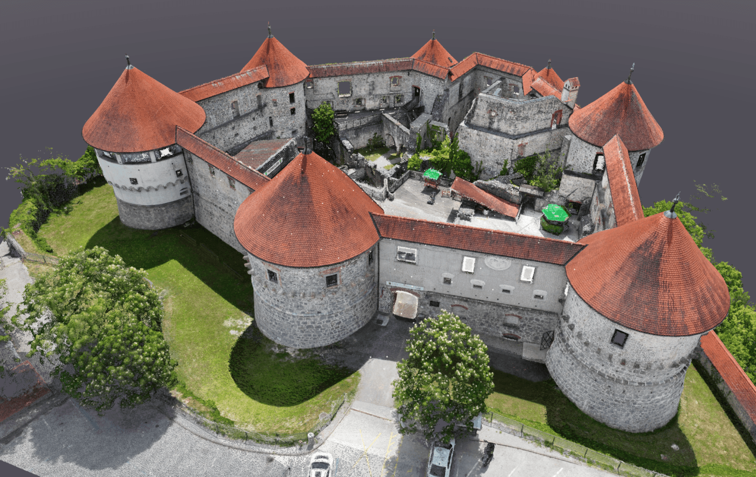
High-density point clouds
At its core, a point cloud is a dense cluster of x, y, and z coordinates that represents the physical surface of your job site. The software extracts millions of these points from the overlapping aerial images you capture in the field.
Point clouds created by an RTK drone are extremely precise, achieving centimeter-level accuracy. In software like 3Dsurvey, points also carry RGB color data, surface normals and possibly intensity value. This transforms the cloud from a simple visual into a rich dataset. You use it for inspection, CAD vectorization, GIS mapping, volume calculations, strict quality control and more.
Accurate Digital Elevation Model (DEM)
Once you generate a point cloud, you need a smooth transition into understanding the terrain. An elevation model is the definitive digital foundation for earthworks, drainage modeling, and infrastructure planning.
The best aerial photo software products automatically classify the point cloud to generate these distinct models:
- DSM (Digital Surface Model): Represents the environment exactly as captured, including buildings, machinery, and trees.
- DTM (Digital Terrain Model): Represents the bare-earth surface. The software strips away vegetation to leave only the true ground.
If you would like to learn more about what a digital elevation model is, you are welcome to check out our blog.
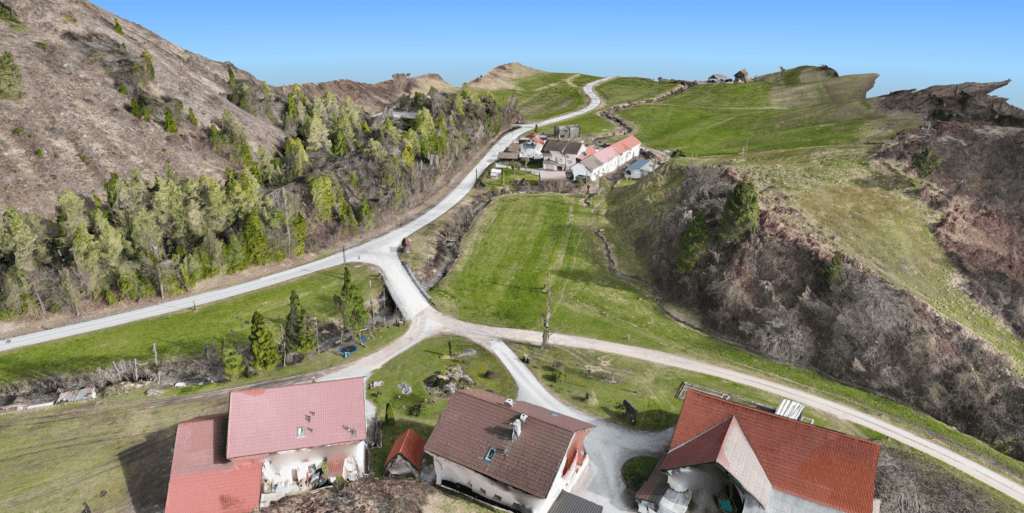
Orthophotos
An orthophoto is a geometrically corrected aerial photograph. The software adjusts your raw field imagery to remove the natural distortions caused by camera lens tilt and varying terrain relief.
You need this in your workflow because it guarantees true scale across the entire site. One meter on the ground translates to exactly one meter anywhere on the digital image, whether you measure at the center or the extreme corners.
This distortion-free output serves as a flawless base map for your CAD or GIS environments. It allows you to confidently identify property boundaries, extract road line work, and measure existing infrastructure without returning to the field.
To learn more about industry standards, read our blog on True vs. Traditional orthophoto.
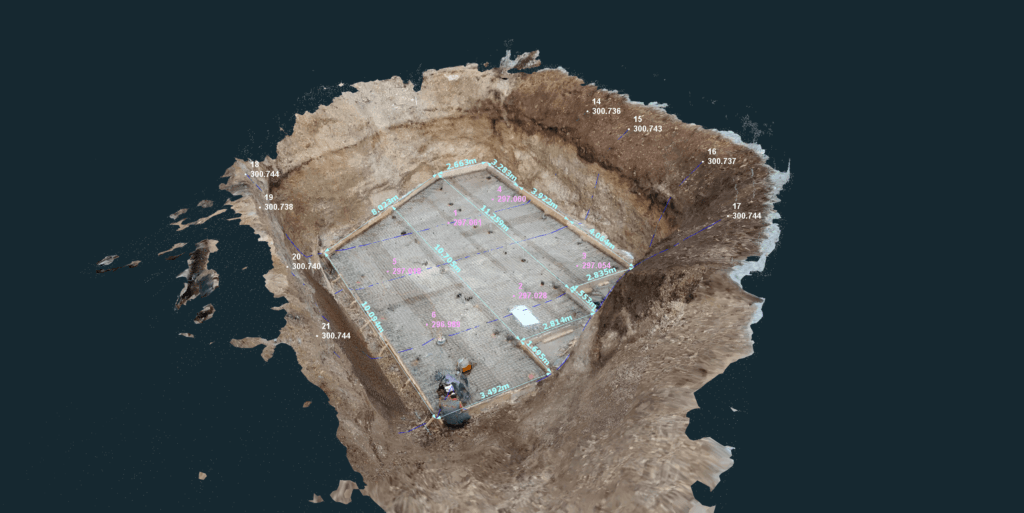
Integrated CAD for vectorization
Surveying and construction projects rely on CAD software to vectorize and measure captured terrain. For land surveying and construction businesses, choosing the right CAD platform is crucial, as it defines workflow, efficiency, and deliverable quality.
Having built-in CAD tools means you can vectorize directly over your point cloud or 3D mesh. You draw breaklines, snap to points, annotate and clean your surveys in the exact same environment. It streamlines your workflow, drastically reducing your office hours and software subscription costs.
3Dsurvey stands out as a rare all-in-one solution, offering a best-in-class integrated CAD tool with an easy learning curve and everything you need in one package. More on this available in the Mastering CAD software blog.
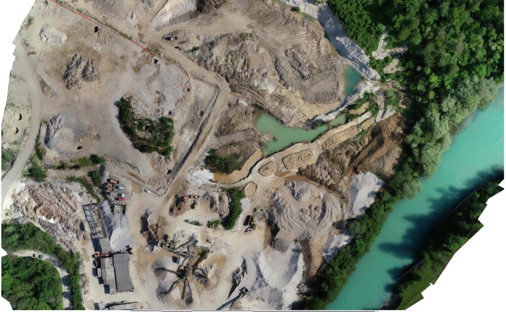
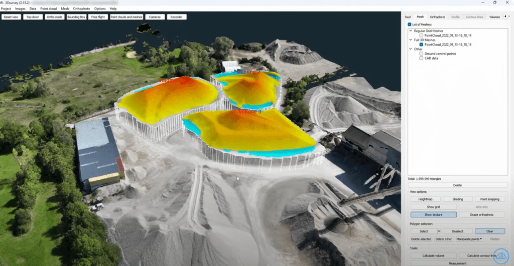
Volume calculation
Calculating volumes shouldn’t require exporting data to complex third-party surface modeling tools. Modern aerial photo software handles site volumes natively with high precision and a straightforward workflow.
You simply outline a stockpile, pit, or active earthwork site to extract exact volume measurements in seconds. If you know the specific material density, you can also convert these volumetric calculations into total weight.
This capability is a game changer for monitoring active sites with fluctuating terrain levels. You can easily track exact cut and fill operations by comparing survey data from different dates directly within the same platform.
Why 3Dsurvey as aerial photo software?
You don’t have time to juggle five different programs to finish one survey. This is why 3Dsurvey is the right solution. It is offering a complete end-to-end solution.
It combines:
- photogrammetry,
- automated point cloud classification,
- DEM and orthophoto generation,
- an industry-leading integrated CAD tool and
- volume calculating tool
into a single platform.
You capture the data, and 3Dsurvey gives you everything you need to deliver professional results with a surprisingly easy learning curve.
Conclusion
Professional confidence comes from trusting your data and your tools. Having a robust platform that handles everything from generating point clouds to extracting CAD measurements is essential for modern land surveying. It eliminates bottlenecks and guarantees precision on every job.
Stop wrestling with fragmented software workflows. Try the all-in-one solution today and streamline your deliverables. Start your 14-day free trial of 3Dsurvey now.

