RTK Videogrammetry module

  1. Home
  2. Products
  3. 3Dsurvey
  4. RTK Videogrammetry

Fast and reliable site documentation for future use

3Dsurvey RTK videogrammetry is a modern approach in surveying and mapping, leveraging the dynamic nature of video to create 3D representations of physical spaces.

A well-documented site is a valuable asset for future use and effective planning and project management. Especially when positions of specific elements are needed.

A fast and efficient approach to site documentation of various construction and engineering projects involving pipelines and underground grid.

Extract the exact measurements, monitor the width and the depth, calculate the volume and extract profile lines.

3Dsurvey SiteScan app and mobile RTK support

RTK Videogrammetry module includes the 3Dsurvey SiteScan app for Android, and mobile RTK support that significantly increases the precision and reliability of the measurements and 3D models produced from video. This is done using corrections from a reference station to improve the accuracy of the satellite positioning data, overriding the often-inaccurate GPS data provided by the mobile phone or tablet.

3Dsurvey SiteScan app display showing a newly renovated tarmac
Land surveyor onsite holding a smartphone with attached RTK GNSS device

All You Need to Get Started

1. Purchase your hardware

2. Download instructions, NTRIP and SiteScan app:

  • Instructions PDF
  • 3Dsurvey SiteScan app APK
  • NTRIP app

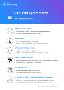
Download: How to Record Guide (.pdf)
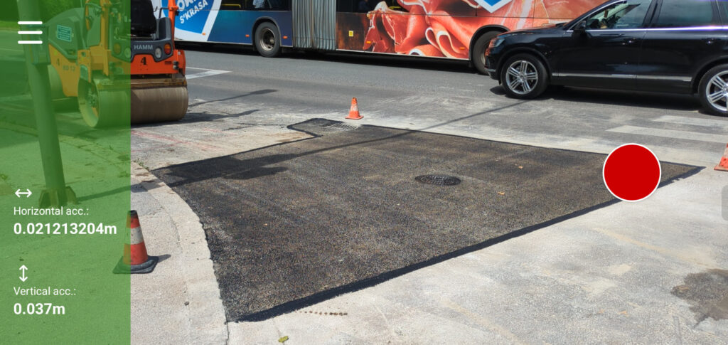
FOCUS ON THE CENTER

  • Keep essential features in the center of the camera sensor
  • Edges can distort images and reduce clarity


WALK SLOWLY

  • Slow movements minimize motion blur
  • Telemetry data updates only once or twice per second


AVOID REPETITIVE FOOTAGE

  • It might confuse surface recognition
  • It might lead to duplicated points or misaligned surfaces


PLAN YOUR PATH

  • Avoid obstacles and ensure safe recording
  • Ensure you capture all the necessary details


BE AWARE OF REFLECTIVE SURFACES AND SHADOWS

  • Reflective surfaces like windows or water cause distorted results
  • Strong shadows can result in a loss of details and information


AVOID WALL PAINTING MOTION

  • Walk during the recording, don’t stand in one place (no painting motion)
  • Rather step back to capture a wider frame
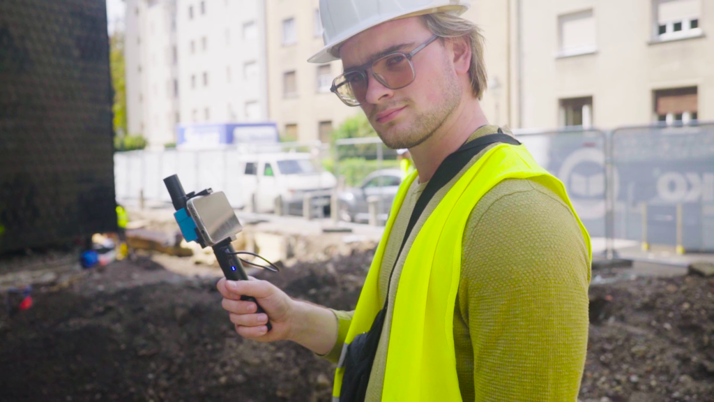
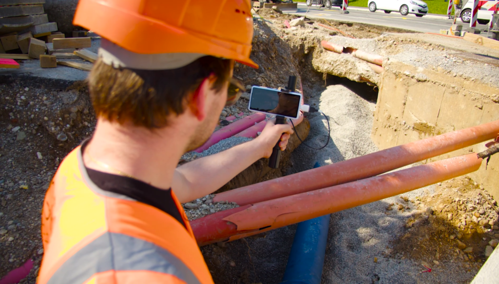
Demo Dataset: Heatline

Don’t have an external RTK GNSS antenna yet? Here is a dataset to explore the capabilities of RTK videogrammetry.

Process the raw data to 3D model yourself or view the processed project:

  • RAW data ZIP (164 MB)
  • Instructions VIDEO
  • Processed results ZIP (700 MB)

Tested devices:

Step-by-step guide

Handheld RTK Videogrammetry with 3Dsurvey. Create accurate 3D models with your smartphone!

A construction worker with an orange hardhat onsite holding a smartphone equipped with an external RTK GPS antennae

Check out the White Paper to discover the level of accuracy you can achieve

This payable add-on module is available to customers with 3Dsurvey version 3.0 and newer.

Check out what our Scan option has to offer

Free Trial - Fully functional, no limitations - for 14 days

Check out all the features and additional modules of 3Dsurvey software and see if it fits your needs, then choose the appropriate licence.

Get started for free

The best way to really test the power of 3Dsurvey!

Pricing

Flexible options, affordable pricing, tailored to your needs.

  • checkmark icon
    All-in-One solution
  • checkmark icon
    Onboarding training included
  • checkmark icon
    Supports 18 languages

Subscribe to our newsletter

What’s new in the field? Stay up to date with our newsletter!