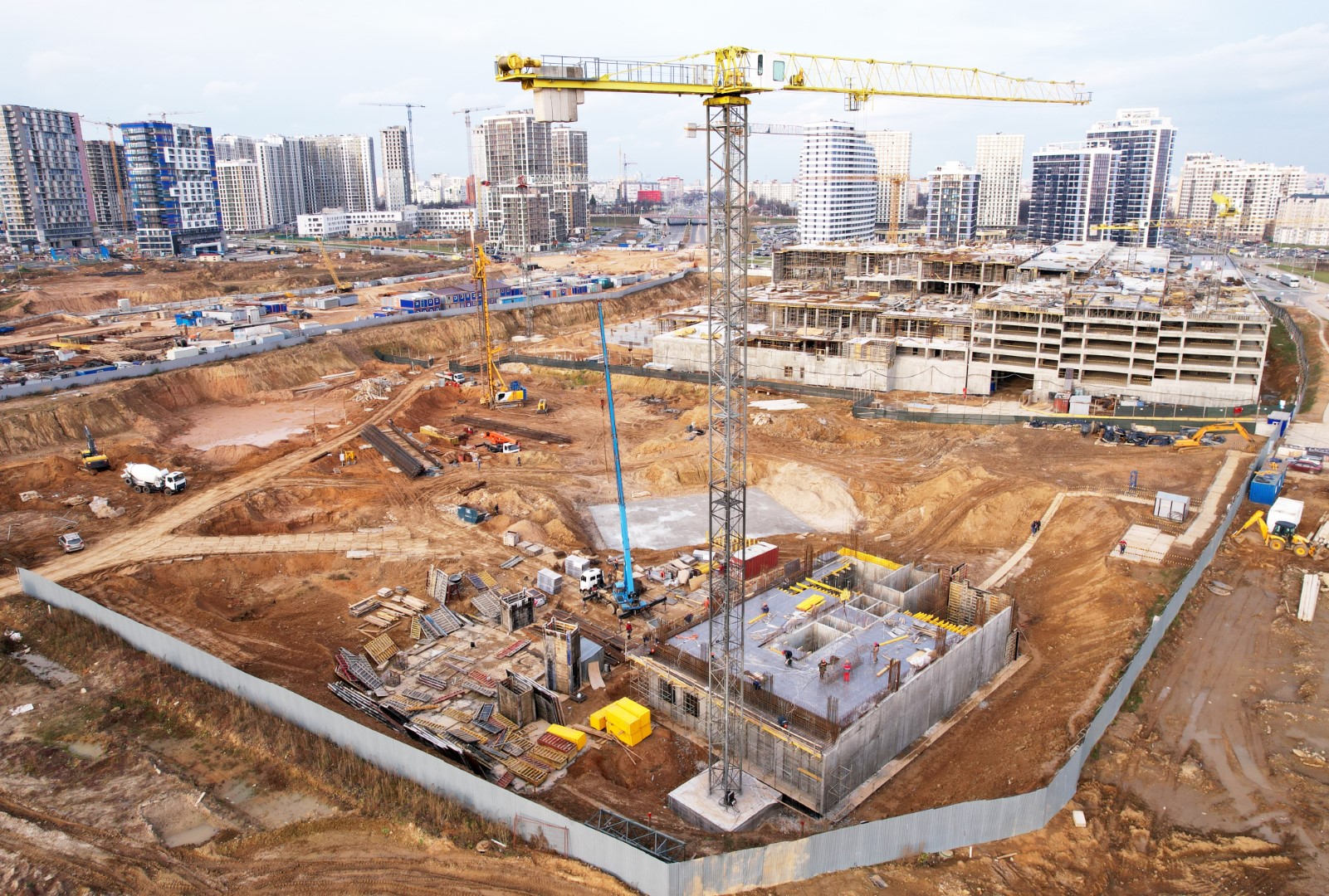
Traditional land surveying can be time-consuming, especially for large construction sites. Photogrammetry accelerates surveying processes, providing rapid and accurate data capture, and reducing the time required for on-site measurements. Drone mapping offers a cost-effective alternative for data collection, while also minimizing the need for extensive on-site personnel.
Improved safety with drone surveying
Better planning and enhanced efficiency
Real-time monitoring of progress
For all the stakeholders involved in construction projects:
Better led construction projects with our photogrammetry solutions
Increased Operational Efficiency
Streamline surveying and data capture processes for increased operational efficiency. Drone photogrammetry and RTK videogrammetry enable faster and more efficient data collection, reducing the time and resources required for traditional surveying methods.
Enhanced Project Planning
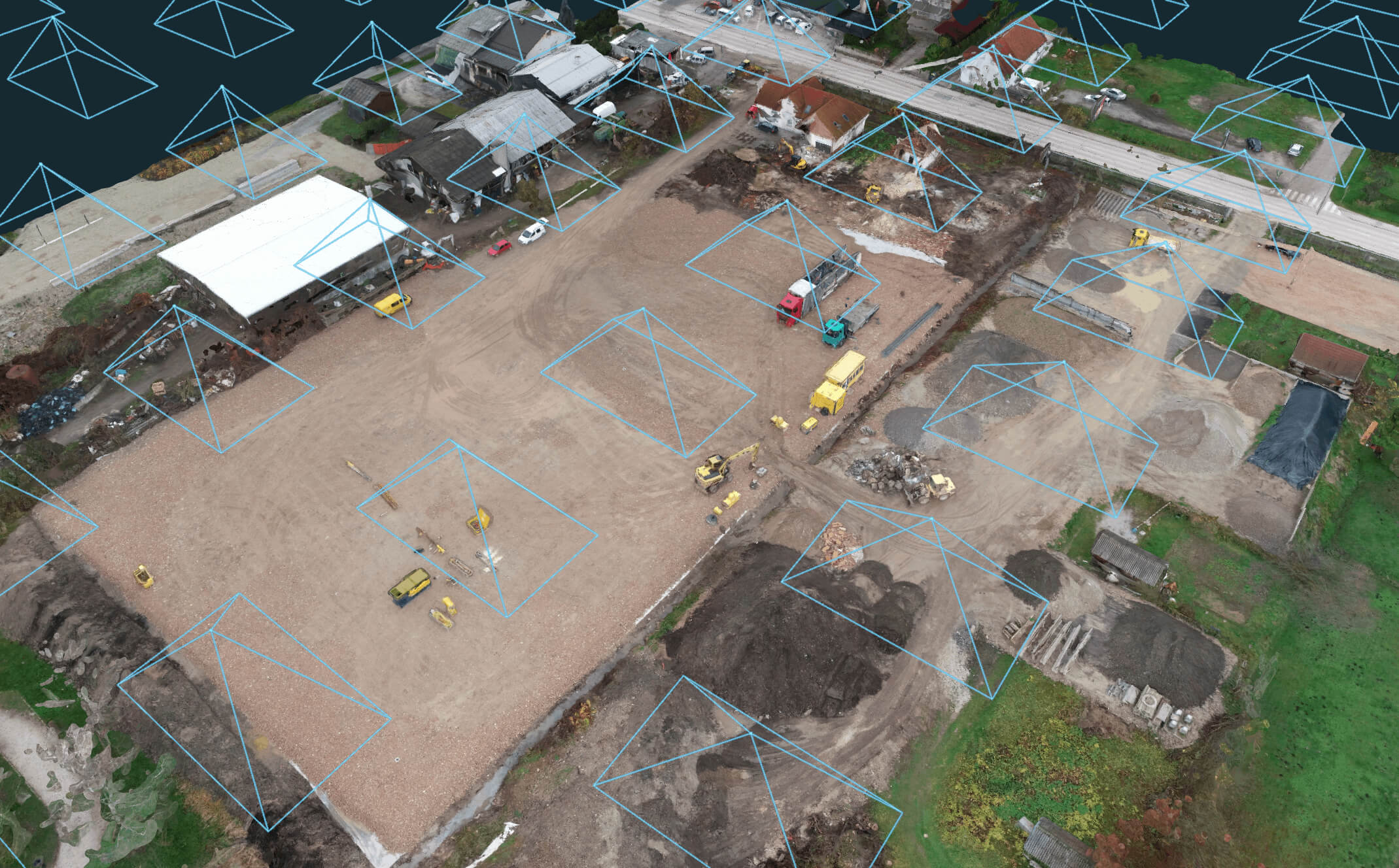
Detailed 3D models and visualizations of the construction site, including the existing terrain, structures, and utilities, created through photogrammetry assist construction firms in comprehensive project planning and analysis.
Use features such as built-in CAD, volume calculation, orthophoto creation, profile lines and cross section creation and more.
Multiple Applications
Use 3Dsurvey software for:
Topographic mapping
Site analysis and planning
As-built documentation
Volume calculations
Construction progress monitoring
Building Information Modelling (BIM)
Terrain and slope analysis
Infrastructure planning
Environmental monitoring
Safety analysis
Easy-to-use user interface with intuitive workflow and seamless integration
While photogrammetry introduces advanced technology, 3Dsurvey is designed for user-friendliness and supports a smooth integration with training and customer support to ease the transition.
Initial setup for photogrammetry, including equipment and software, involves an investment, but the return on investment is rapid due to significant reductions in survey time, labor costs, and error rates.
Photogrammetry provides highly accurate data, with precision dependent on the quality of the imagery and the technology used. 3Dsurvey ensures high-quality outputs that are reliable for critical decision-making.
Drone use is regulated by local and international laws which must be adhered to. 3Dsurvey provides guidance on compliant operation, ensuring that privacy and legal standards are respected.
Yes, comprehensive training materials and sessions are part of the 3Dsurvey package, enabling your team to quickly become proficient in using the software effectively.
3Dsurvey commits to continuous updates and improvements, keeping the software at the forefront of technological advancements to protect your investment.
Photogrammetry is especially suited for large and complex sites as it can efficiently process extensive data sets to produce detailed and accurate 3D models and topographic maps, facilitating better project management and design accuracy.
The most valuable information comes from the clients
Mihala Korelc GEO2 d.o.o. (Slovenia)
Claudiu Toma Black Light SRL (Romania)
Kamil Tomiak NaviGate (Poland)
One of the reasons that I am a 3Dsurvey partner, is because their customer service is unbeatable, and because they put out an INCREDIBLE amount of content, to help YOU, the user, make the most out of the software. They are constantly taking feedback from their customers and putting out helpful webinars, videos, and articles to help you work your job and find solutions to your hang ups.”
Farrah Etcheverry Etcheverry Land Surveying
Jan Škarja Šuštar Trans (Slovenia)
3Dsurvey’s support and customer care have surpassed all of our expectations. Marko, Vid and Matija are true professionals, prompt to respond and always happy to help with solutions at hand. Even though we sometimes make their days hard, they make our lives easier – thank you for doing the best job!


 All-in-One solution

