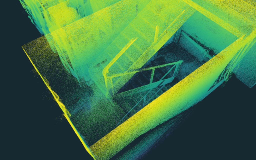
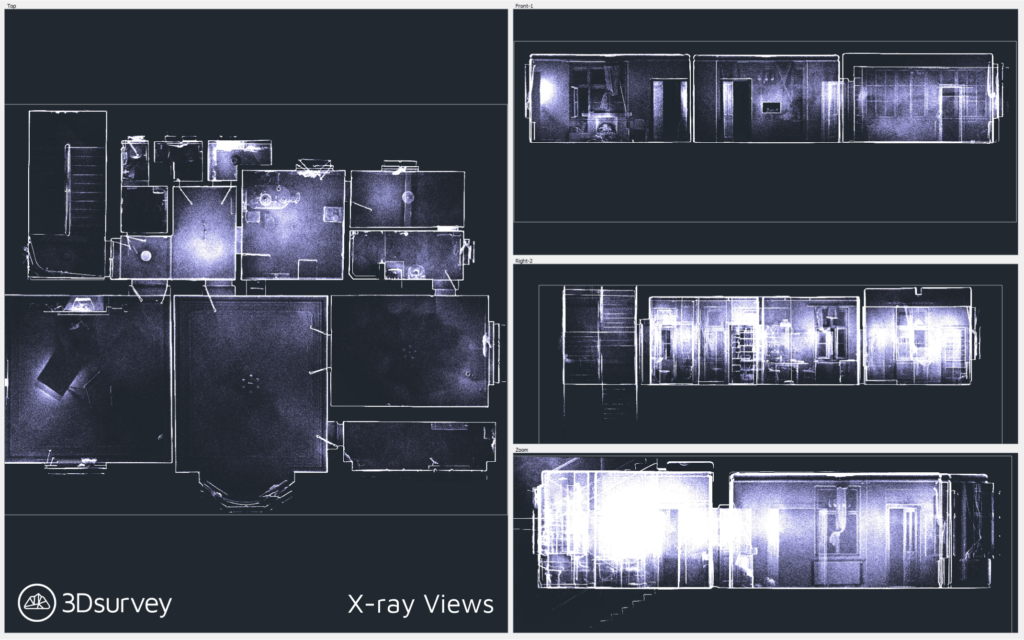
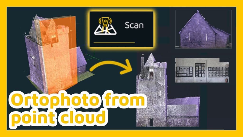
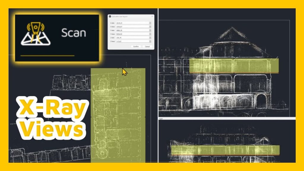
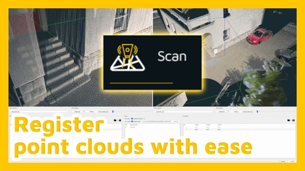
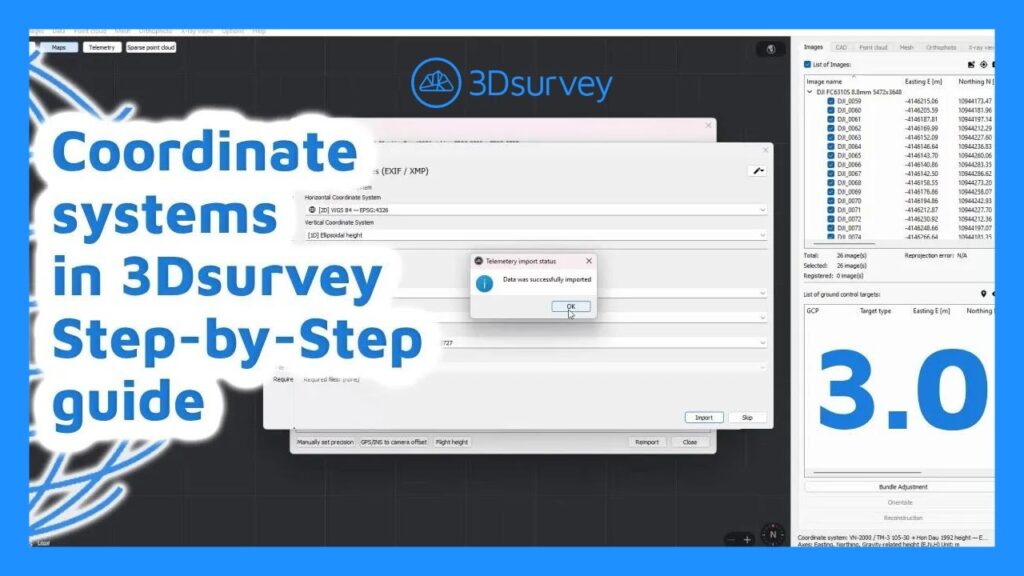
Key takeaways 3Dsurvey’s Scan module lets you import and work with high‑precision scan data (e.g., FARO Orbis) in common formats like .e57 and .laz. With X‑ray views, you can visualize and draw structural floor plans and cross-sections directly on the point cloud. CAD integration inside 3Dsurvey enables quick drawing, snapping to layers, and editing even for […]
Unparalleled Data Integration in One Software
In the rapidly evolving world of geospatial technology, surveyors are increasingly in need of tools that can seamlessly integrate diverse data sources into a unified project. The latest release from 3Dsurvey addresses this demand with precision. By offering advanced add-on modules such as Scan and RTK Videogrammetry, alongside significant enhancements to core functionalities, 3Dsurvey Version 3.0 sets a new standard for data integration, streamlining workflows and boosting accuracy for professionals in the field.
Handheld RTK Videogrammetry with 3Dsurvey
Creating Accurate 3D Models with RTK Videogrammetry Create accurate 3D models with your smartphone. How? Watch our step-by-step guide for handheld RTK videogrammetry with 3Dsurvey software. https://www.youtube.com/watch?v=LqPkCF-cDC0 Introduction to Videogrammetry Welcome to our videogrammetry tutorial! We’ll show you how to capture high-quality footage using an RTK device and mobile phone, turning it into a precise […]
Creating an Orthophoto from a Point Cloud in 3Dsurvey
Welcome to this quick tutorial on how to generate an orthophoto directly from a point cloud in 3Dsurvey. Let’s walk through the steps for creating both standard and custom-plane orthophotos using point cloud data. Watch the tutorial 1. What’s New? You can now create orthophotos not just from dense meshes but also directly from point […]
Mastering X-Ray Views in 3Dsurvey
Welcome to another 3Dsurvey tutorial! In this guide, we’ll explore the X-Ray Views feature—an advanced visualization tool available in the 3Dsurvey Scan module. If you’re already familiar with the X-Ray Orthophoto, introduced a few versions ago, you’re in for a treat: this new update allows you to generate orthophotos from any axis—top-down, front-back, or left-right. […]
Aligning Terrestrial Laser Scans in 3Dsurvey
In this tutorial find out how to align terrestrial laser scans with the use of manual or automatic registration for a unified point cloud. Watch the tutorial Step 1: Loading Point Clouds into 3Dsurvey Start a new project in 3Dsurvey. Navigate to the Point Cloud tab. Load your laser scans by browsing for your data […]
Setting up Coordinate system in 3Dsurvey 3.0
Welcome to 3Dsurvey tutorials. In this tutorial you will learn how the updated coordinate system in 3Dsurvey 3.0 works. Watch the tutorial Using Preset Coordinate Systems Step 1: Start by Typing Your Country Name The easiest way to set up coordinate systems in 3Dsurvey is by using one of the built-in presets. To begin, simply […]
Using AprilTags for small projects – Domaćica cookies
Key takeaways AprilTags (fiducial markers) were used to establish control points for photogrammetry in a small project. The markers allowed accurate geo-referencing without the need for GPS or expensive control setups. 3Dsurvey detected the AprilTags automatically and used them for precise alignment of images. The workflow simplified the process, especially helpful for smaller projects. Final […]
RTK videogrammetry: Driving geospatial innovation
In the realm of geospatial innovation, RTK (Real-Time Kinematic) videogrammetry stands as a pivotal advancement, transforming how surveying professionals capture and utilise spatial data. Building upon the principles of photogrammetry, RTK videogrammetry integrates real-time GPS corrections to enhance accuracy and efficiency of data collected using a smartphone. This article delves into the intricacies of RTK […]
What’s new in 3Dsurvey 3.0
Major improvements in 3Dsurvey are here! v3.0 was released on June 27th 2024. Introducing our newest version: 3Dsurvey 3.0 with add-on module capability! WHAT’S NEW OVERVIEW: 3Dsurvey Add-on Modules: Introducing RTK Videogrammetry and Scan modules for enhanced data capture and processing. Major Coordinate System Upgrade: Experience seamless data integration with a robust coordinate system upgrade. Automatic […]


