In the realm of geospatial innovation, RTK (Real-Time Kinematic) videogrammetry stands as a pivotal advancement, transforming how surveying professionals capture and utilise spatial data.
Building upon the principles of photogrammetry, RTK videogrammetry integrates real-time GPS corrections to enhance accuracy and efficiency of data collected using a smartphone. This article delves into the intricacies of RTK videogrammetry, exploring its technological foundations, practical implementations, and the transformative impact it holds for the geospatial industry.
Technological Foundations
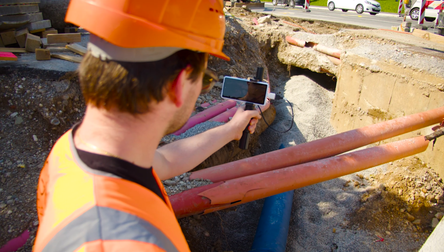
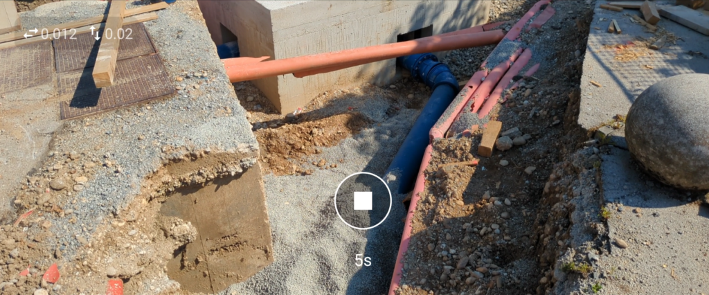
RTK videogrammetry merges the capabilities of videography with precise positioning technology. It utilizes continuous video footage captured at high frame rates (typically around 30 FPS), ensuring ample data and sufficient overlap for robust 3D model reconstruction. The incorporation of RTK GPS technology with a video enabled scanning app (3Dsurvey SiteScan) provides centimeter-level accuracy in real-time, overcoming the limitations of standard built-in smartphone GPS which typically offer accuracies of several meters.
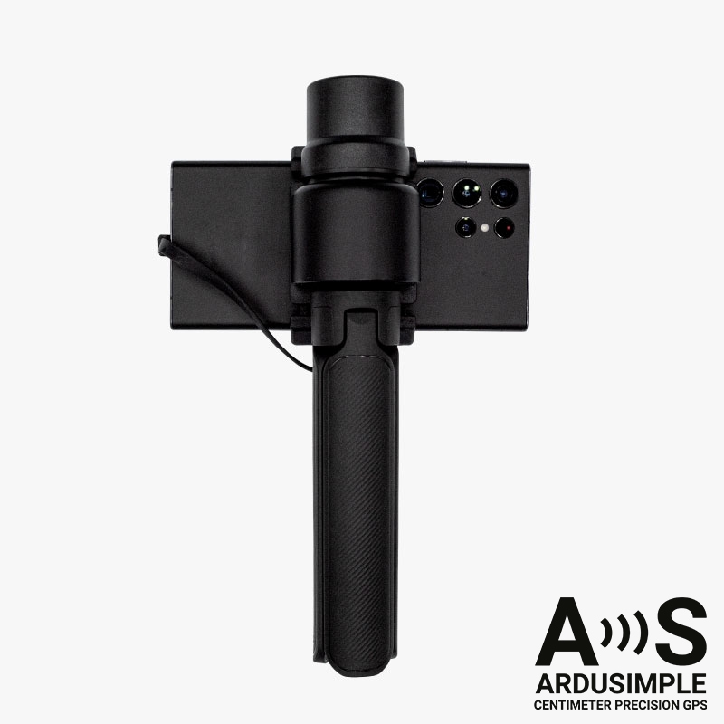
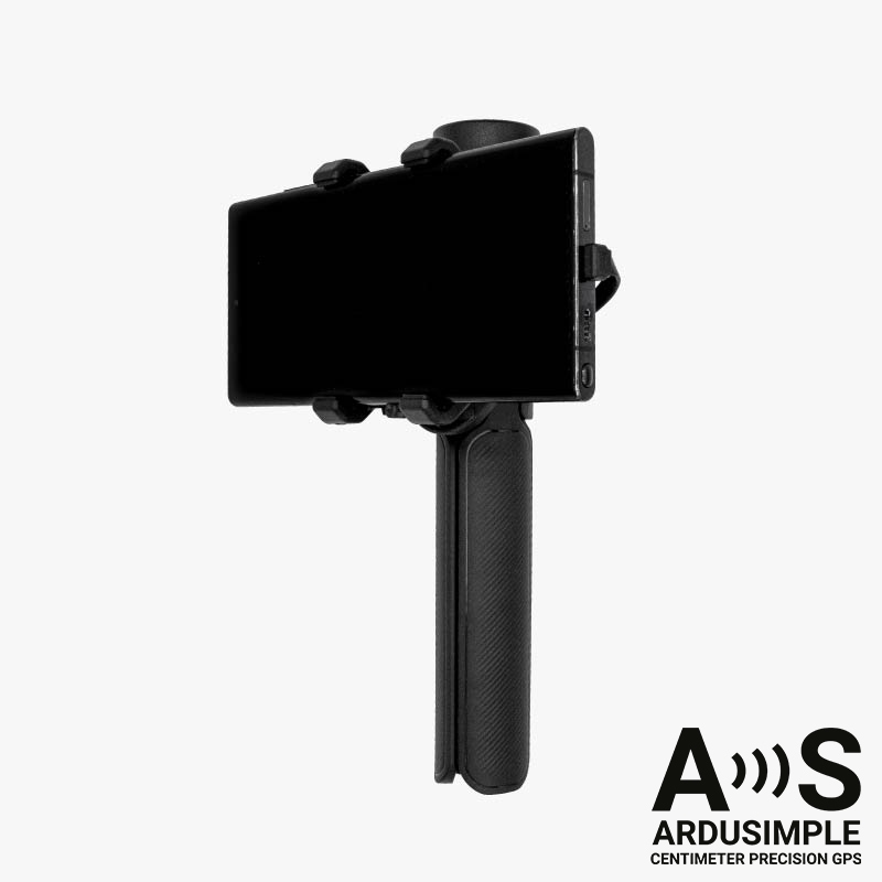
Central to RTK videogrammetry is the integration of specialized hardware. Modern smartphones equipped with external RTK antennas, such as ArduSimple’s ZED-F9P receiver, exemplify this synergy. These devices leverage corrections from local NTRIP providers, enhancing geotagging precision and enabling seamless integration of spatial data into geospatial workflows.
Practical Implementations
The practical applications of RTK videogrammetry span a wide spectrum of industries, each benefiting from its unique capabilities:
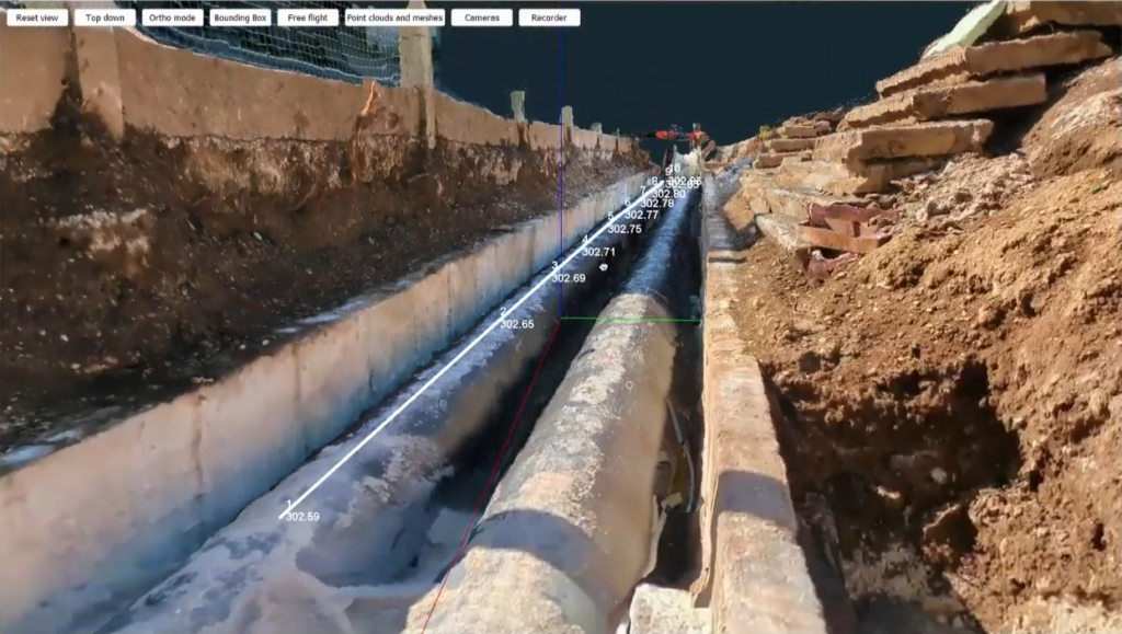
- Infrastructure Development: In civil engineering projects, RTK videogrammetry facilitates precise documentation of construction progress and infrastructure installations. For instance, monitoring underground pipe installations or tracking the excavation of foundations can be efficiently managed with real-time, accurate spatial data.
- Cultural Heritage Preservation: RTK videogrammetry excels in documenting cultural artifacts and heritage sites. Its ability to capture intricate details with minimal setup time makes it invaluable in archaeology and museum conservation efforts, where traditional surveying methods may be impractical or disruptive.
- Small-Scale Construction Projects: RTK videogrammetry is highly effective in small-scale construction projects where detailed, high-accuracy data is required over limited areas. For example, during residential construction, it can document progress, verify the dimensions of foundations, and ensure that structures are built to specifications. The portability of smartphones allows for quick site visits and immediate data processing, making it easier to monitor ongoing work and identify potential issues early.
- Utility Maintenance and Inspection: Maintaining and inspecting utilities such as telecommunication lines, electrical cables, and water pipelines often requires precise and up-to-date spatial data. RTK videogrammetry enables utility companies to quickly capture detailed footage of utility corridors, identify faults or damage, and plan maintenance activities. The high accuracy of RTK data ensures that even small deviations from expected conditions can be detected, improving the reliability and efficiency of maintenance operations.
Transformative Impact
The advent of RTK videogrammetry signifies a paradigm shift in geospatial data acquisition. By reducing reliance on complex and expensive surveying equipment, it democratizes access to high-precision spatial data capture. This accessibility fosters innovation by enabling more agile and responsive data-driven decision-making processes across sectors.
Furthermore, RTK videogrammetry enhances the scalability of surveying operations. Its compatibility with existing drone-based photogrammetry and LiDAR technologies allows for comprehensive data fusion in software solutions such as 3Dsurvey, yielding richer datasets that encompass both macro and micro-scale perspectives. This integrative approach not only enhances the accuracy of 3D models but also broadens the scope of applications, providing detailed infrastructure or terrain mapping assessments.
Challenges and Future Prospects
Despite its transformative potential, RTK videogrammetry confronts several challenges. These include the management of large volumes of video data, mitigation of environmental factors such as lighting and onsite obstructions, and the need for continuous technological refinement to optimize processing speeds and accuracy.
Looking forward, ongoing advancements in image processing and sensor technology promise to further enhance the capabilities of RTK videogrammetry. Future innovations may focus on real-time data streaming and automated analysis, bolstering its utility in dynamic environments and time-sensitive applications.
Conclusion
As technology continues to evolve, RTK videogrammetry holds the promise of becoming an indispensable tool for geospatial professionals, empowering them to achieve new levels of precision, efficiency, and insight in their projects. Through its integration of cutting-edge hardware, software advancements, and best practices, RTK videogrammetry not only enhances the accuracy of spatial data but also accelerates the pace of innovation in the geospatial industry. As such, it heralds a future where precision meets accessibility, enabling smarter, more informed decisions that shape our physical and digital landscapes alike.
To find out more, check out our RTK Videogrammetry add-on module.

