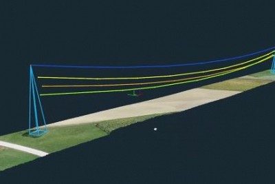
In this webinar we will guide you through surveying solution for utilities, providing faster and safer site surveying, with a high level of accuracy.
Marko will show you how to plan a mission for power lines mapping (most effective flying height of your UAV, vertical and horizontal overlaps), directly from the field and how to effortlessly create a high-quality 3D model of a power line right from your workstation.
3Dsurvey offers complete control of your overhead power line assessments, photogrammetric data processing, and more. Join us!

