Key takeaways
RTK‑enabled cameras were used during video capture, providing highly accurate GNSS data embedded in the footage.
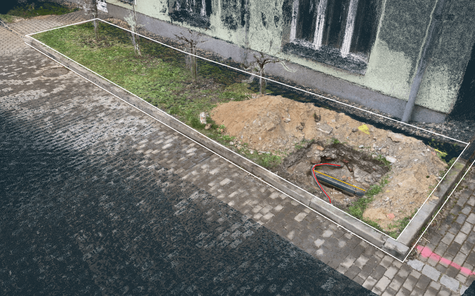
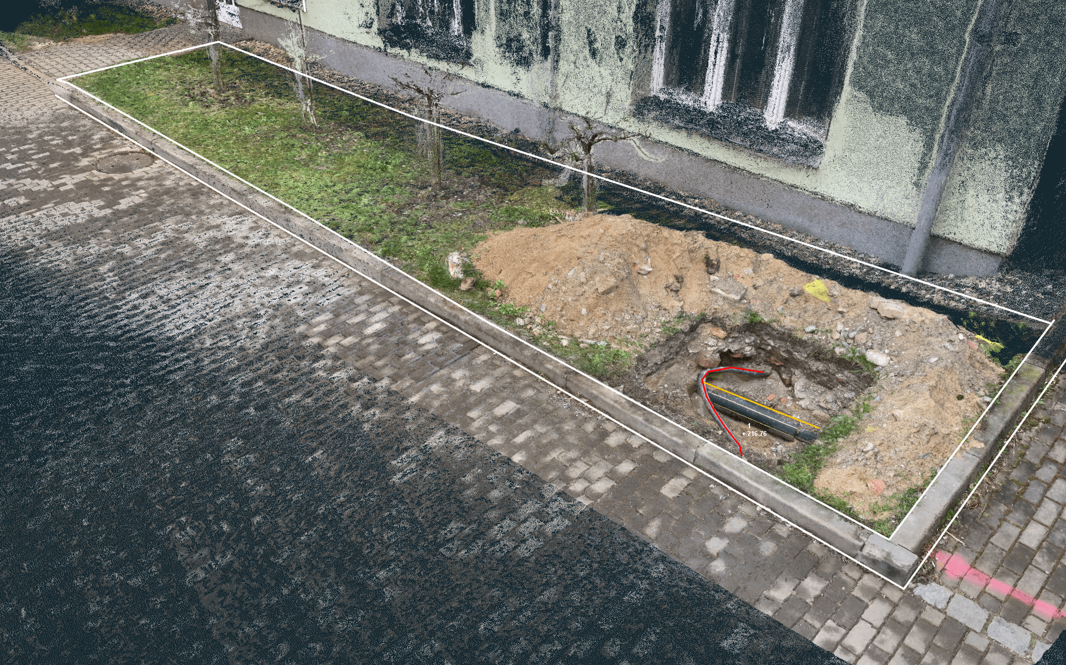
3Dsurvey processed video frames to reconstruct a dense, georeferenced 3D point cloud using photogrammetric triangulation.
The workflow eliminated the need for traditional static photo workflows, enabling efficient, continuous data capture.
RTK data ensured high positional precision, enabling accurate alignment and scaling of the 3D model.
The generated model was compatible with further analysis, CAD measurements, and deliverables like orthophotos or meshes — offering a powerful, modern alternative for survey-grade 3D modeling.
Introduction
In the evolving landscape of 3D data collection, it’s essential to recognize that drones are not the only tool in the arsenal. Today’s 3D world is enriched by a variety of methods, from high-precision ground scanning to innovative videogrammetry using mobile phones.
As a Gold Level Partner of 3Dsurvey, 3gon Positioning s.r.o., led by Pavel Bozdech in the Czech Republic, has demonstrated the power of the software in real-world applications. Among the latest advancements is the RTK Videogrammetry module which offers a unique solution for 3D data collection taken by smartphone.
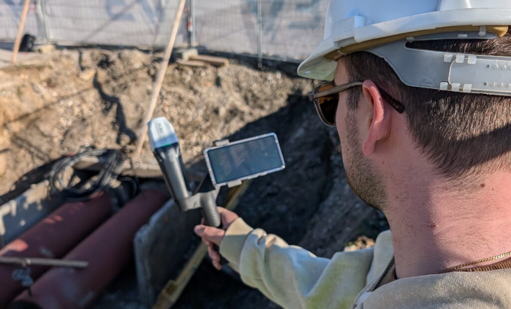
RTK Videogrammetry involves users connecting a precise RTK GNSS antenna to a mobile phone. This setup provides centimeter-level accuracy for the phone’s position, enabling the creation of a 3D point cloud and 3D mesh from video recordings. Unlike drones, which require skilled operators and are restricted in certain areas, mobile phones offer a quick and accessible alternative for capturing detailed 3D data.
This case study highlights the practical application of the RTK Videogrammetry module in a project carried out by 3gon Positioning s.r.o., showcasing how 3Dsurvey’s innovative tools can be utilized to achieve precise and efficient results in challenging environments.
Project Overview
The primary goal of the project was to utilize 3Dsurvey photogrammetry software to integrate 3D data collection into smaller projects using simple, cost-effective tools. The specific focus was on documenting and capturing 3D reality with sufficient detail and precision, making advanced 3D data accessible even for projects with limited resources.
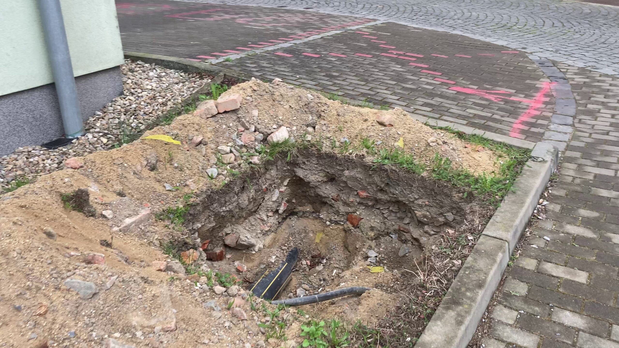
The project aimed to document urban and construction sites with high accuracy using the RTK videogrammetry functions of 3Dsurvey. The objective was to create detailed 3D models that could be used for various applications, including construction monitoring and site documentation, without causing disruptions on busy sites.
Site and Conditions
The project was conducted in urban areas and on active construction sites where minimal disruption was essential. The sites were busy, and it was crucial to avoid causing any inconvenience or interruptions to ongoing activities. No significant preparations were required before using the software. However, it was recommended to survey the site beforehand to plan the optimal route and areas to capture. The simplicity of videogrammetry meant that no major challenges were anticipated. The process is inherently adaptable to various site conditions without requiring extensive preparation.
Technology and Methodology
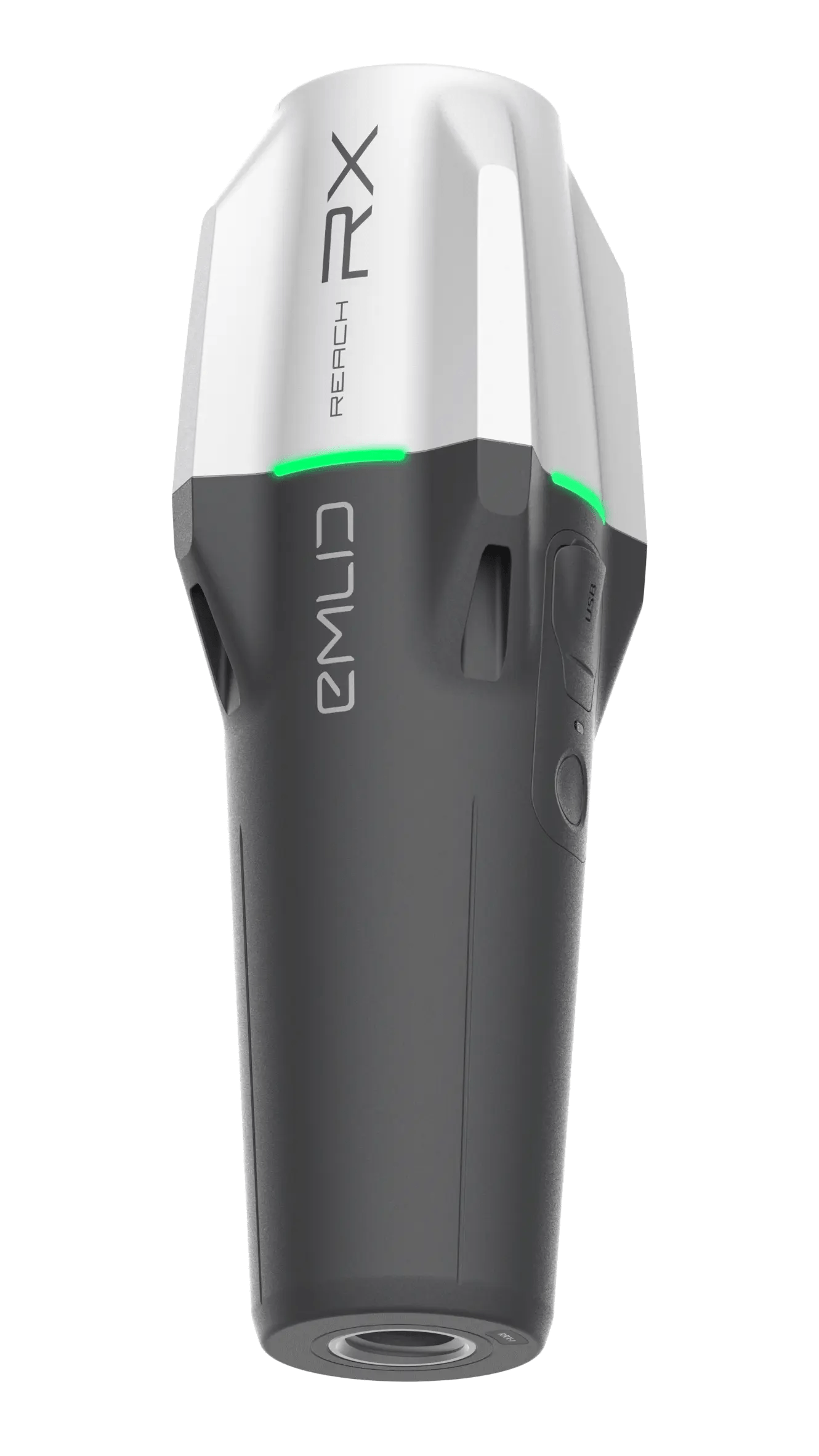
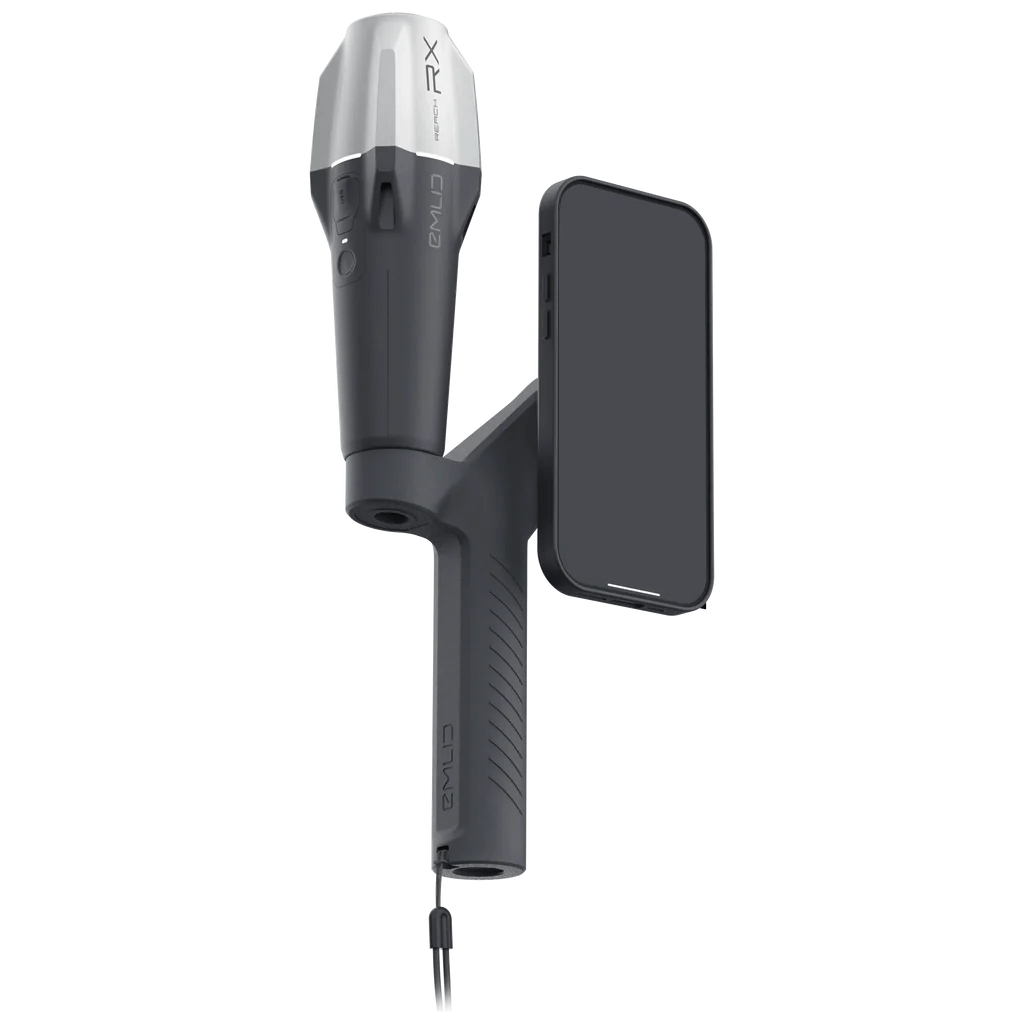
Equipment Used: The project utilized an Android mobile phone connected to an EMLID GNSS device for RTK positioning, providing centimeter-level accuracy. The equipment was easy to set up, requiring only the measurement of the offset between the phone and the GNSS antenna, which was then entered into the 3Dsurvey application.
Data Collection Process: RTK videogrammetry was employed by simply recording video of the site. The process was straightforward, akin to using a drone for aerial data collection, with the user advised to move smoothly to ensure data quality. Ground control points were used to verify accuracy independently, providing an additional layer of precision.
Problem-Solving Approaches
One of the primary challenges was maintaining a consistent RTK position, as the GNSS device requires a clear view of the sky to function properly. However, this did not significantly impact the project, as alternative methods such as ground control points were available to ensure data integrity.
Traditional methods of 3D data capture, such as using a total station or a pure GNSS rover, were considered but found less suitable for this project due to their complexity and cost. The simplicity and accessibility of videogrammetry made it an ideal choice, bridging the gap between classical survey techniques and the practical needs of construction teams.
The decision to use 3Dsurvey was based on criteria including precision (up to 14 cm), equipment availability, cost, and operator skill level. The software’s ease of use, affordability, and quick deployment made it the preferred solution for this project.
Data Processing and Analysis
3Dsurvey facilitated data processing by offering a straightforward workflow similar to drone data processing. The key advantage was the software’s ability to extract images from video footage and process them into 3D models with ease.
The use of 3Dsurvey significantly improved efficiency by reducing dependency on surveyors and allowing on-site data collection by non-experts. This method provided a new, efficient way to capture 3D reality, particularly beneficial for smaller projects where traditional surveying methods would be overkill.
The innovative use of RTK videogrammetry allowed for the capture of 3D data without the need for expensive equipment or specialized personnel, making it a groundbreaking approach in the industry.

Outcomes and Results
The data obtained through RTK videogrammetry was highly accurate, with results showing a precision of up to 5 cm using surveying-grade GNSS equipment. This level of detail was more than sufficient for most mapping and documentation tasks.
The use of 3Dsurvey software resulted in significant time savings and increased efficiency. It enabled construction and utility teams to capture data in the field independently, reducing the need for surveyors and minimizing delays. This approach also allowed surveyors to expand their service offerings, handling data processing while contractors managed field data collection.
Compared to alternative methods, the results from 3Dsurvey were comparable to 3D scanning but more suitable for smaller projects. The dedicated 3Dsurvey SiteScan app for Android simplified the process further, enhancing the project’s overall effectiveness.

Lessons Learned
The success of the project was attributed to the simplicity of the equipment and software, allowing non-experts to capture and process 3D data effectively. The ability to draw on both images and point clouds simultaneously was a significant advantage.
The insights gained from this project demonstrated that videogrammetry is a viable replacement for traditional surveying methods in many applications, offering a new perspective and approach that can be leveraged in future projects.
Future Applications
The RTK videogrammetry functions of 3Dsurvey have the potential to revolutionize data capture for various applications, including volume calculations, street mapping, construction documentation, and 3D modeling for design purposes.
As the technology continues to develop, it is expected that videogrammetry will become a standard tool in the industry, reducing the fear of 3D technology and making it accessible to a broader range of users.
The use of 3Dsurvey in this project exemplifies how innovative solutions can address industry challenges, providing efficient, cost-effective, and precise data capture methods that cater to a wide range of applications.
Find out more about the RTK Videogrammetry module here.

