From Buying a Drone to Using It for Accurate 3D Models
Webinar
Introduction to Drone Use in Geodetic Surveying
The use of drones, or unmanned aerial vehicles (UAVs), in geodetic surveying has become increasingly common, allowing surveyors to cover areas ranging from 10 to 1000 hectares in just a few hours. However, selecting the right drone is crucial. With various types available—such as multicopters, fixed-wing aircraft, and hybrids—the first challenge is choosing the aircraft that best meets your project’s needs.
Drone Selection and Flight Planning
In the first section of the lecture, we will discuss the technical specifications of drones that are essential for geodetic use, such as flight planning and the control procedure for different types of aircraft. Additionally, we’ll dive into best practices for data recording, including the correct method for setting checkpoints. Understanding these processes ensures that the drone captures accurate data during its flight, and we’ll cover the optimal parameters to ensure a smooth and successful operation.
Fundamentals of Photogrammetry
The second part will introduce the fundamentals of photogrammetry and its importance in engineering geodesy. We’ll go through the essential stages of image processing, including georeferencing, point cloud calculation, and terrain model generation. Additionally, we’ll explore the calculations necessary to produce accurate orthophotos and clarify the differences between digital terrain models (DTM), digital surface models (DSM), and orthophoto outputs (DOF and true DOF). This section will equip you with the knowledge to transform your drone’s captured data into actionable geospatial information.
Practical Examples and Project Calculations
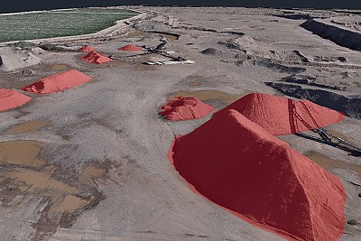
Moving forward, we will present real-world examples of calculations that can be performed using the data obtained from photogrammetry. These practical examples will illustrate the types of analysis that can be done, helping participants understand how to apply the theory to their own projects.
Drone Imaging in Classical Geodetic Projects
In the final part, we will explore classical geodetic projects where drone imaging was successfully integrated. We’ll cover how photogrammetric data was processed into the desired displays and how this data can be exported to third-party CAD programs. Additionally, we’ll discuss the cost-effectiveness of using drone technology in these scenarios, offering a comprehensive view of its advantages in modern geodetic work.

