Technology drivers such as drones and photogrammetry software in the geospatial industry are creating the wind of change. Drone-mapping enables organizations to tackle operational challenges – allowing them to perform digital asset databases.
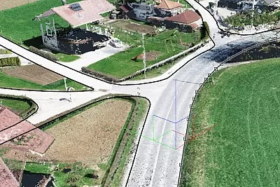
In this webinar we will show you exactly how easy it is to map a 10 kilometers of road with the help of a drone and our 3Dsurvey software. We’ll be providing all the necessary steps, from capturing the data using DJI Phantom RTK drone, to creating your first road map with 3Dsurvey.
Marko will show you what is important for safe data capture in the field (flying within line-of-sight, start from the highest point, inspect the route before the flight so you don’t hit trees, power line cables or phone transmission antennas. …). He will show you how to plan flight missions (entire workflow for the linear mission in the DJI RTK application) and how to properly set up the camera for best results. Marko will also describe why it makes sense to divide the whole project into pieces and map 1km with one battery.
In the second part of the webinar, Marko will show you the workflow of processing the captured data in 3Dsurvey with end results (orthophoto and point cloud). He will go thru purpose of the project, how much time he saved, what problems he solved, what were the main benefits, …
Drone mapping can provide project data back in a day that could take a land surveyor more time and money using traditional methods. It’s a safer, faster, and more efficient opportunity for construction companies working on road mapping projects. Our aim is to empower you with all the knowledge and skills needed to be able to create your own accurate road mapping at a fraction of the price.

