Key takeaways
Drone photogrammetry was used to document archeological ruins, capturing both visible surface and structure details.
High-resolution 3D point clouds and textured meshes were generated, preserving precise geometry of archeological features.
Ground Control Points (GCPs) ensured accurate georeferencing of the archaeological site.
Terrain classification tools helped isolate ground surfaces from built or collapsed features.
Archaeologists used the 3D data to measure volumes, plan excavations, and analyze site stratigraphy.
Generated orthophotos, cross-sections, and CAD drawings were used for documentation, restoration planning, and public presentation.
The workflow offered a non-invasive, efficient, and precise way to digitize and preserve archeological sites for research and conservation.
Introduction
How to create a 3D model of a statue? Easy. Today the statue is of the Christian Saint Hubert, who is the patron saint of hunters, mathematicians, opticians and metalworkers. He renounced hunting after having his vision of encountering a stag. The purpose of this data collection was for the archival of cultural heritage and 3D documentation which could be the basis for reconstruction & restoration.
The process
With the help of an ordinary digital camera, we photographed the zinc statue of Saint Hubert and a deer outside Bistra Castle in Slovenia. We calculated a textured 3D model from the photos in our 3Dsurvey software.
Archaeological conservation
Archaeological conservationists play an important role in the monument protection service. Modern heritage protection encompasses more than simply the protection of buildings and objects. By considering the spatial totalities and values of the cultural environment, it brings together the expertise of the fundamental disciplines of archaeology, architecture, ethnology, landscape architecture, urban history, and the specialist knowledge and theoretical approaches of conservation, restoration and preventive archaeology.
Project tools and specs
- Drone: None. Just hand shots from a standard digital camera
- Camera: Olympus EP2 (12M pix camera)
- Number of GCPs: 3 – local coordinate system
- Area of interest: 5 x 5m
3D model results
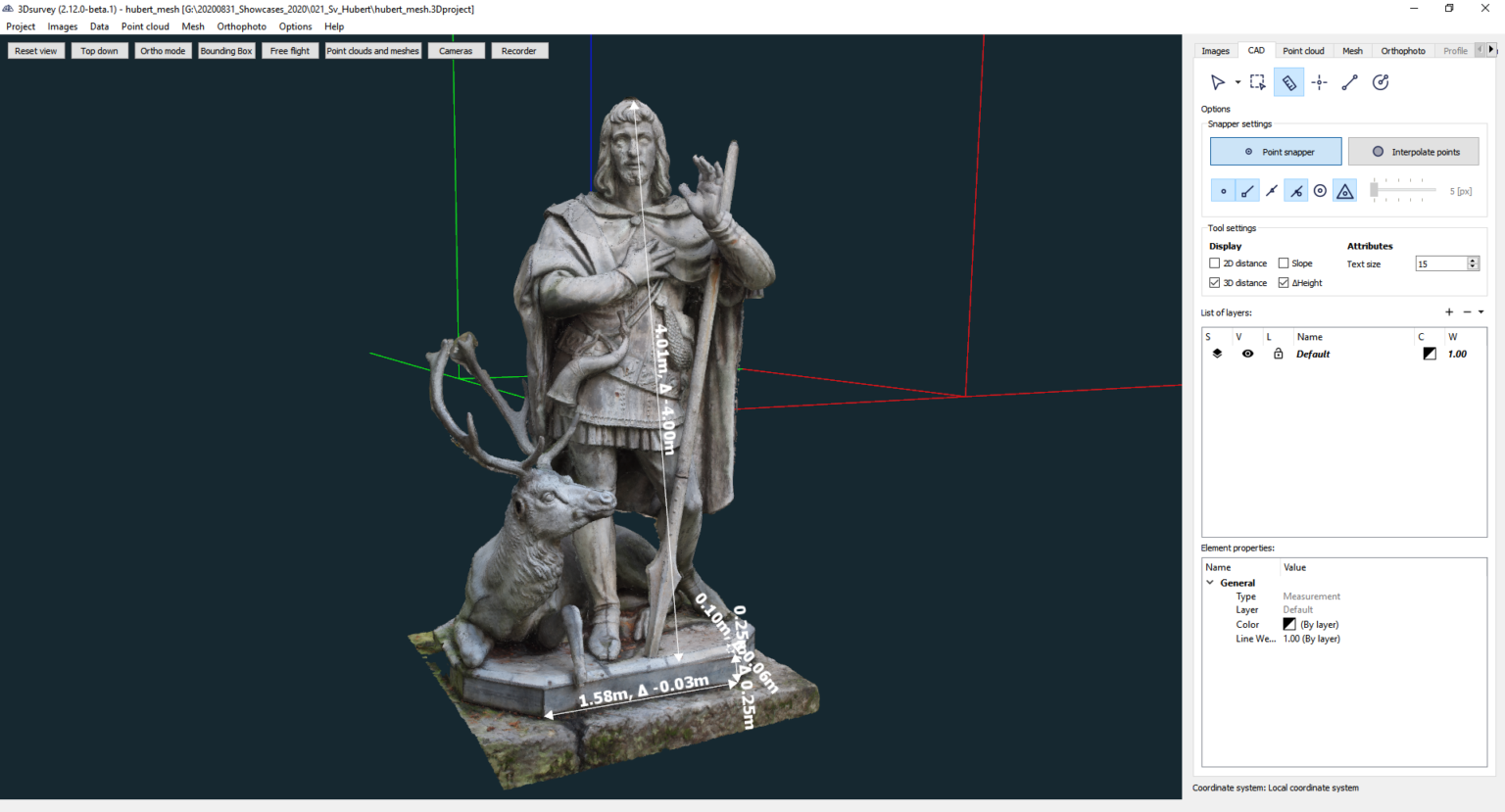
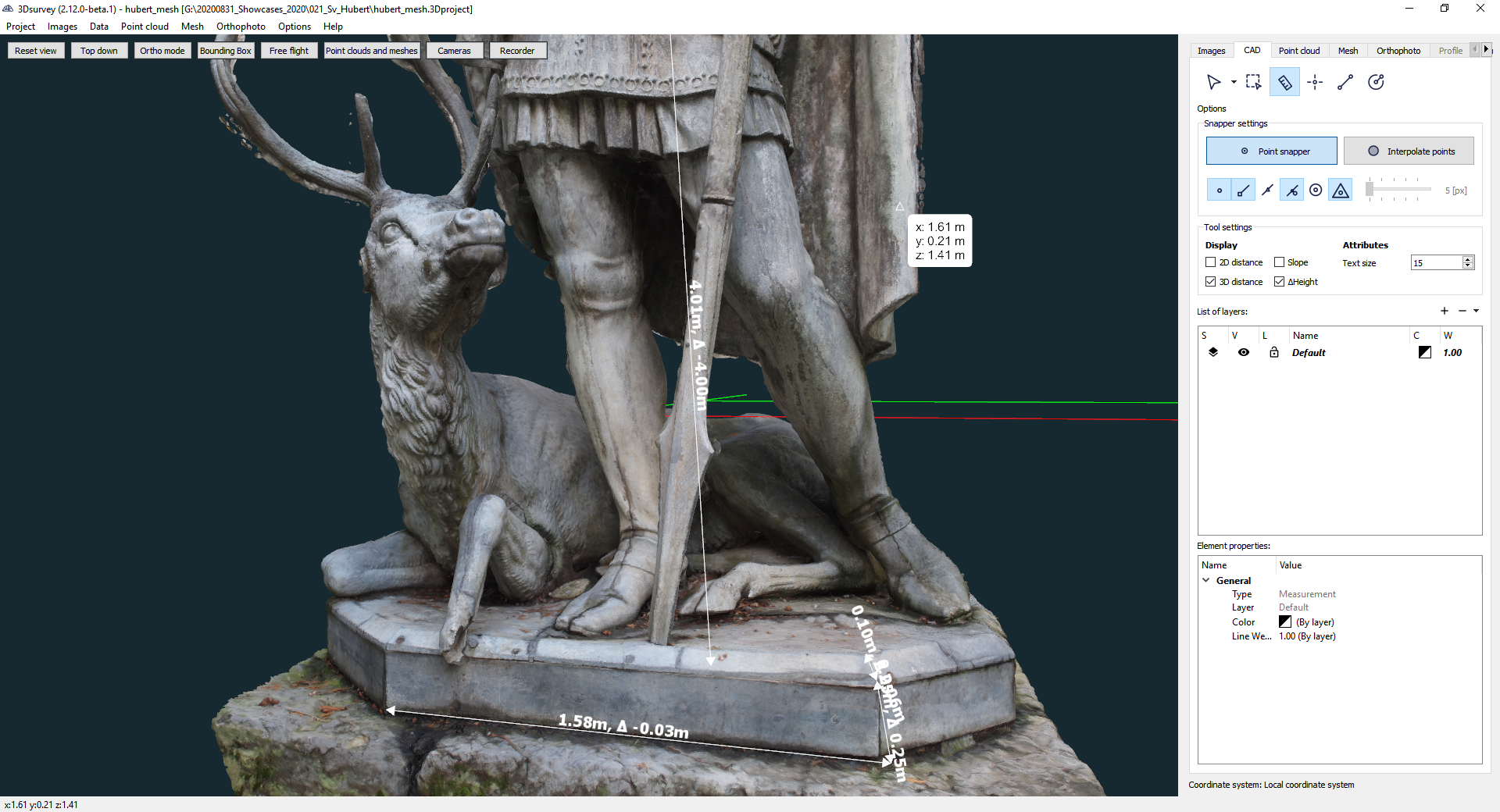
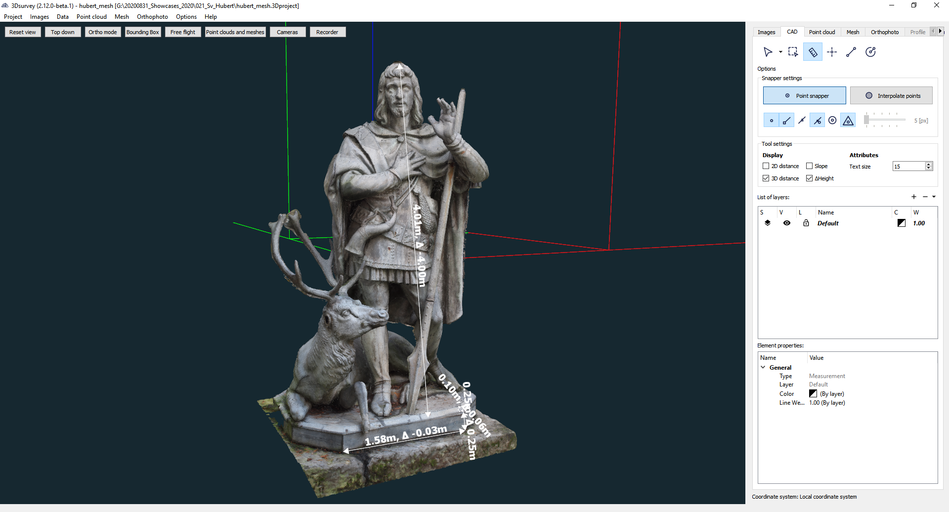
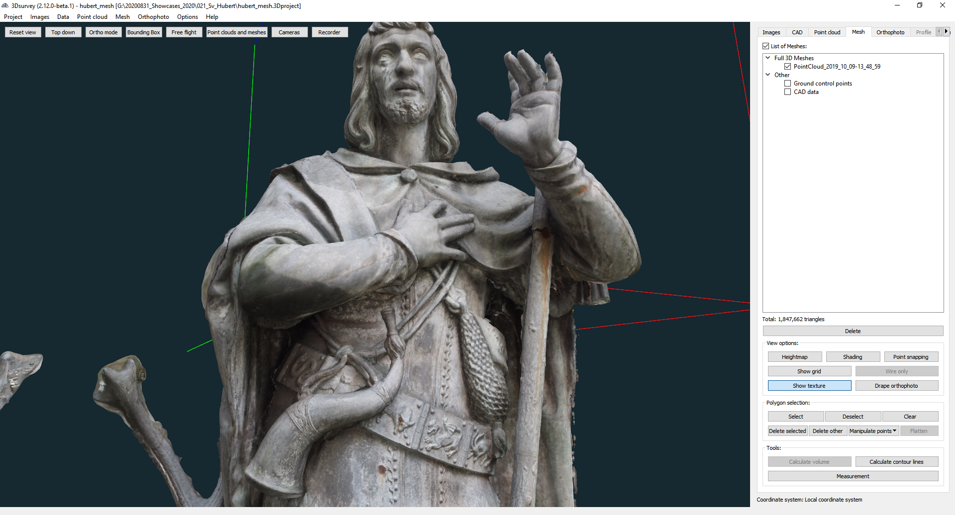
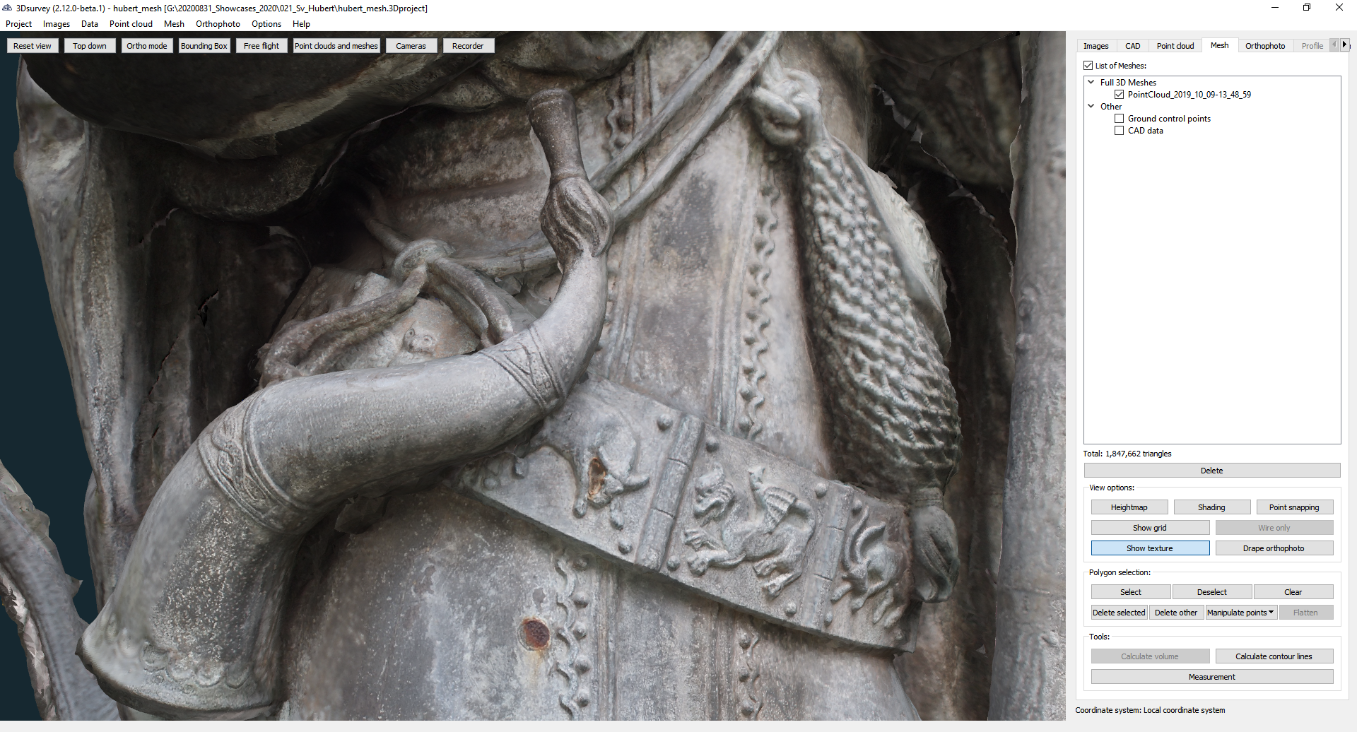
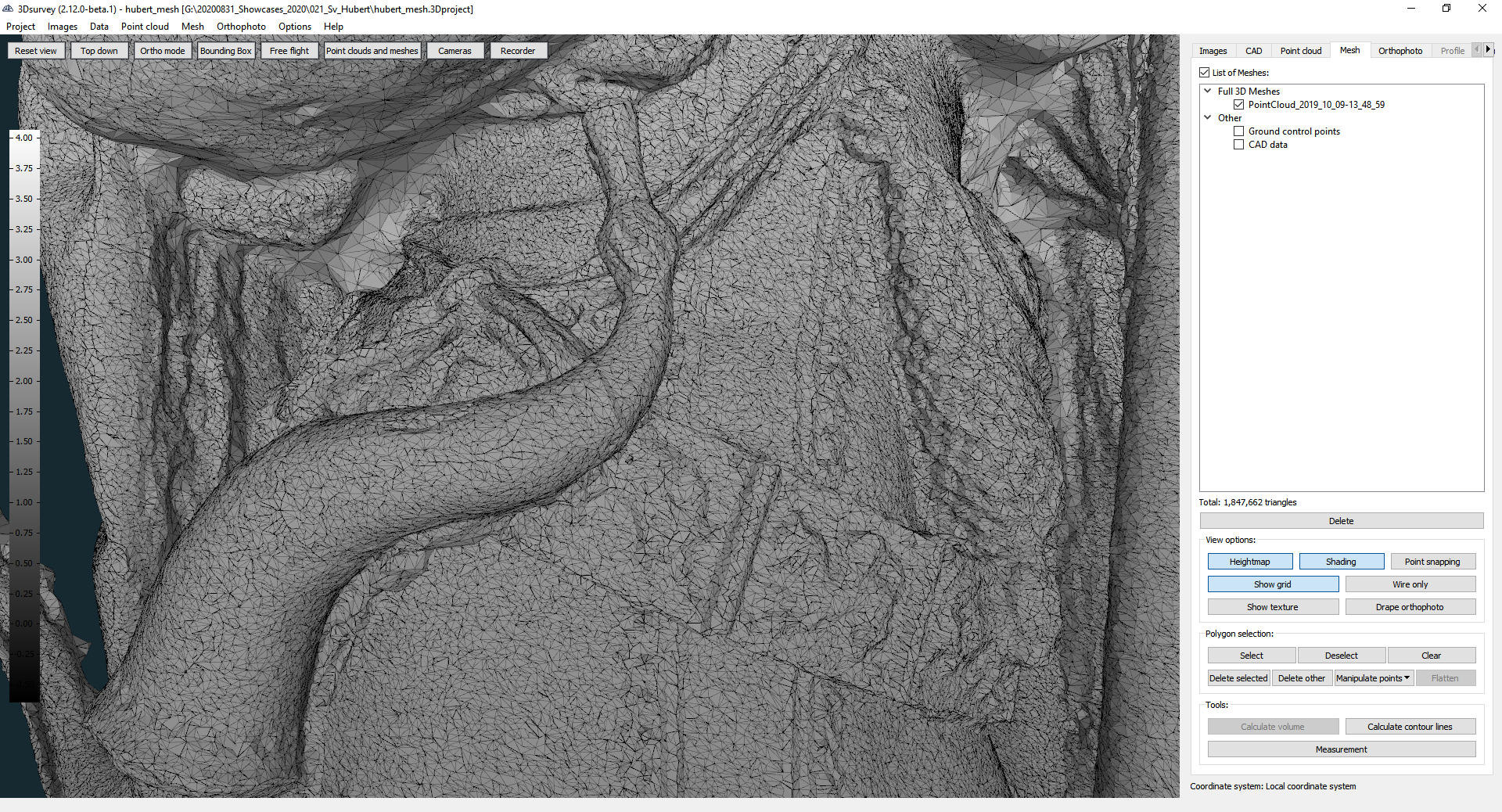
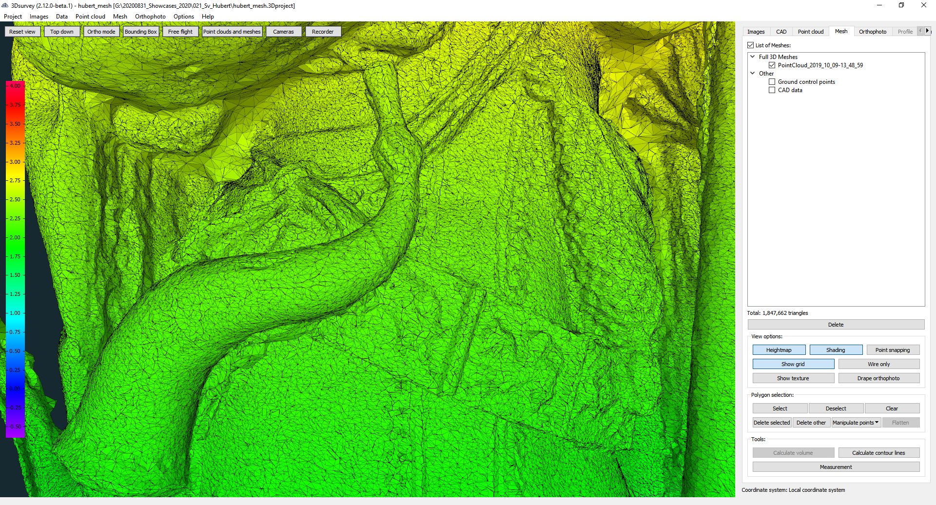
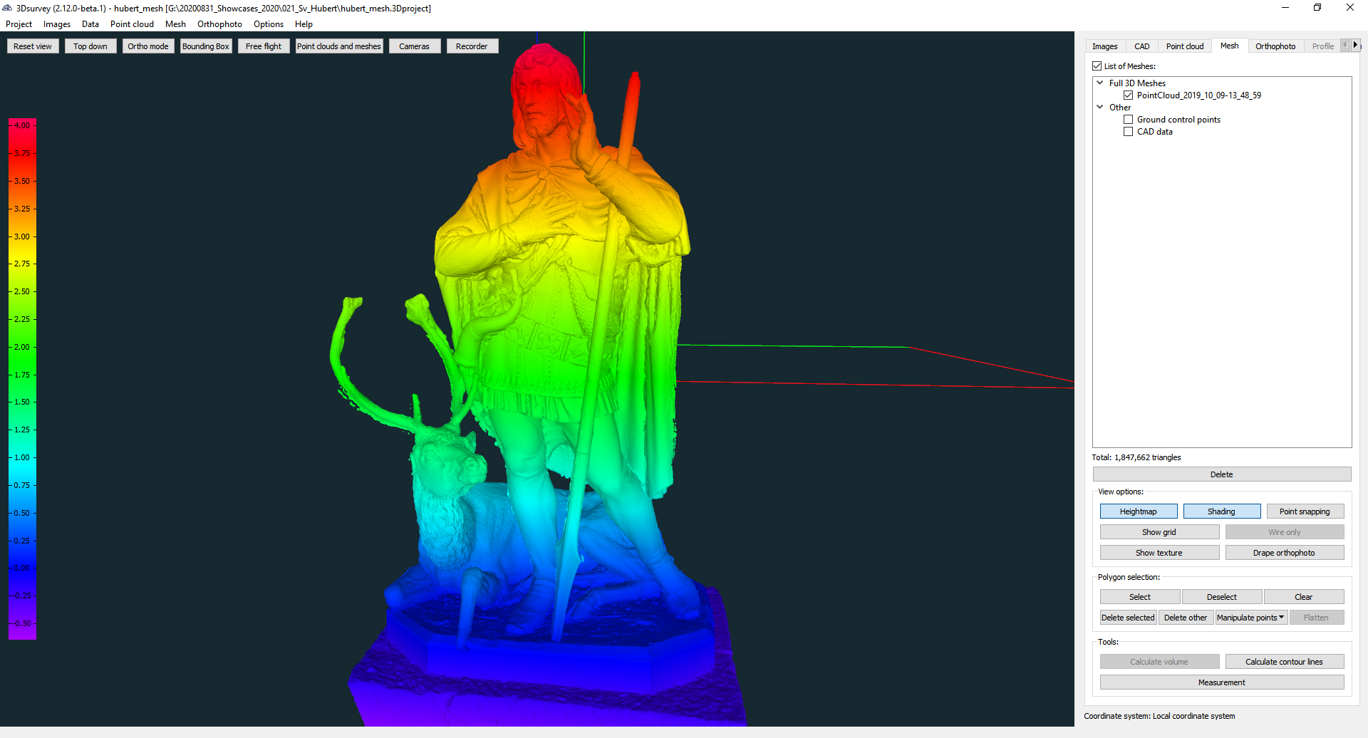
Have a look at the images below to see the 3D model. Notice the level of detail and texture. We used our integrated CAD tools to measure the statue at just over 4 meters. This is also visually represented by the height map.
Do you need to do some 3D documentation of an old building or statue? Try 3Dsurvey for free for 14 days. Click here.

