What is an Elevation Model? DEM, DSM and DTM Explained
Key takeaways
An elevation model maps height values across a site, terrain, or surface.
Digital elevation model is a broad term for digital models that describe elevation. Digital surface model captures everything on the surface and Digital Terrain Model represents the bare-Earth surface
Elevation models help with planning, flood risk analysis, earthworks, volume calculations and many others.
3Dsurvey lets you create, edit, inspect, and export elevation data in a single workflow.
Introduction
An elevation model (in practice often casually called “elevation map”) is the definitive digital foundation for any infrastructure, engineering, or earthworks project. Instead of relying on outdated topographic maps, modern workflows allow you to capture a site using drones or LiDAR with high precision. By processing this data, you can extract the exact terrain and build a reliable digital surface that drives confident decision-making from day one.
What actually is an elevation model?
A digital elevation model (DEM) is a representation of the Earth’s surface that provides elevation values for every point across a project area. It is created from geospatial data, typically captured via drones, UAVs, or LiDAR, and is essential for analyzing terrain, slopes, and surface features.
Modern point-cloud processing software makes generating these models highly efficient. The primary prerequisite is a classified LAS point cloud file. If you want to know more about what a point cloud is, you can read our blog.
Once you extract the initial surface, you can clean the data using editing and smoothing algorithms to remove inconsistencies and sharp edges. The entire process can now be completed in a matter of hours, requiring minimal user input beyond setting your core model parameters.
Differences between a DEM, DSM, and DTM
Understanding the exact differences between these three geospatial models is critical, as they serve entirely different purposes and are not interchangeable.
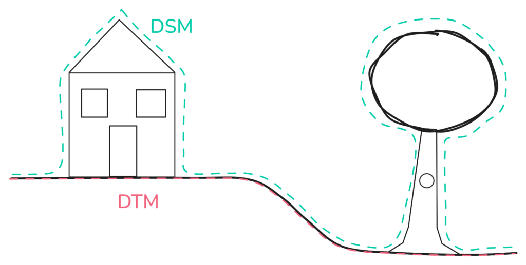
Schema showing the difference between DSM and DTM.
DEM (Digital Elevation Model): is a broad term for digital models that describe elevation. It includes both DSM and DTM, along with other elevation-based models that we will not cover in this blog, such as canopy height models, bathymetric models, or specialized hybrid models.
DSM (Digital Surface Model): Represents the environment exactly as it was captured. It includes both the natural terrain and all above-ground features. If a tree, a building, or a piece of machinery was on-site during the survey, it is mapped in the DSM.
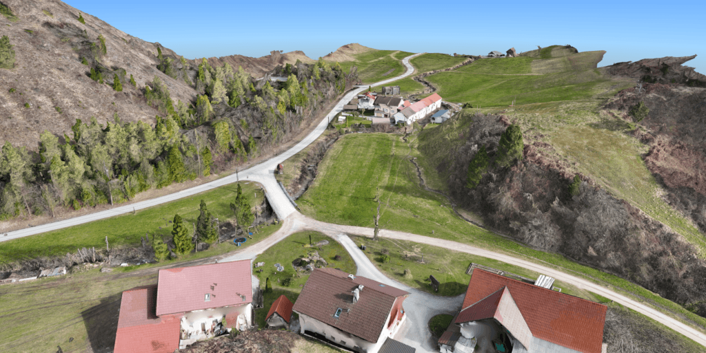
Digital surface model (DSM) processed in 3Dsurvey.
DTM(Digital Terrain Model): Represents the bare-Earth surface. To create this, the software applies classification algorithms to digitally remove buildings and strip away vegetation, leaving only the true ground behind
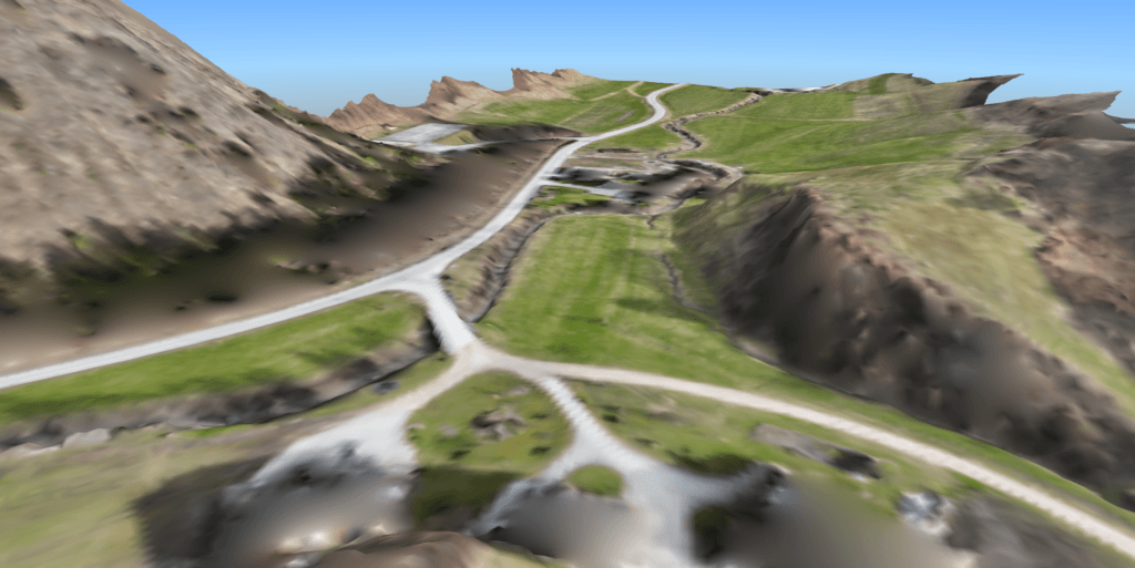
Digital terrain model (DTM) processed in 3Dsurvey.
The image below shows a before and after comparison of a DSM transitioning into a DTM following classification, visualized with a heatmap.
3 Use cases of an elevation model
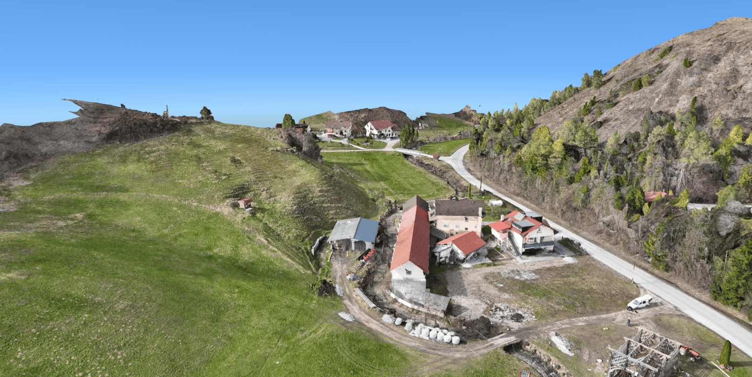
1. Site planning and feasibility
An accurate elevation model provides the exact slopes, contours, and topological data needed to understand a site before construction begins. By visualizing the terrain digitally, engineers can design infrastructure that works with the landscape rather than against it. Elevation models are essential for:
Route selection for roads and railways
Site placement for large infrastructure assets
Early-stage project feasibility assessments
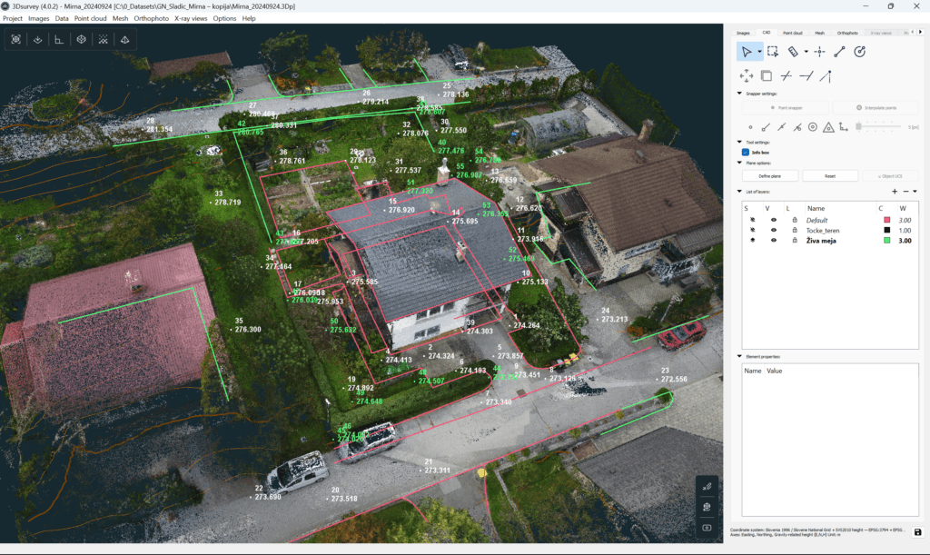
House and street vectorization done in 3Dsurvey.
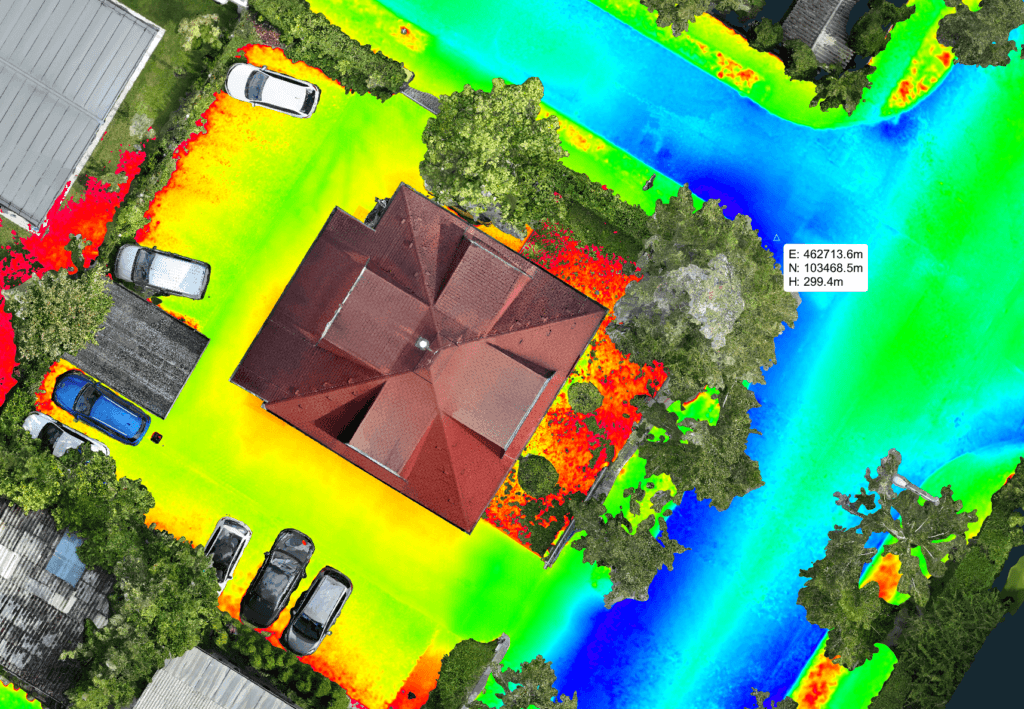
2. Flood risk and drainage modeling
Since water naturally flows along elevation gradients, highly accurate terrain data is vital for flood mitigation. Elevation models allow teams to simulate surface water movement, identify low-lying pooling areas, and plan efficient drainage systems. This data is actively used for:
Designing stormwater flow paths
Positioning drainage infrastructure accurately
Identifying and avoiding flood-prone zones entirely
Surface elevation model used for water drainage assessment done in 3Dsurvey.
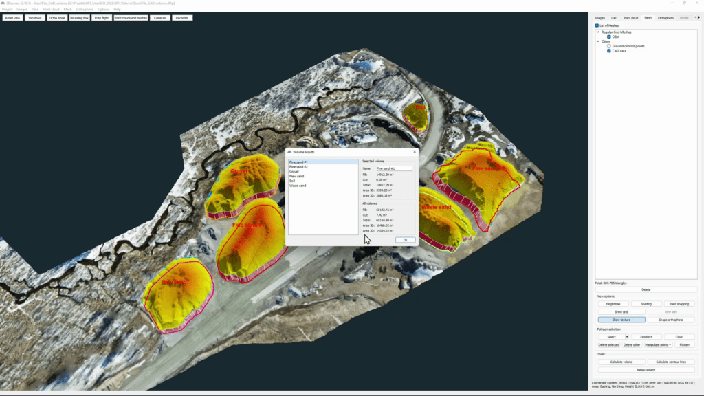
3. Earthworks and volumetrics
Small errors in earthmoving estimates can lead to significant cost overruns. An up-to-date elevation model replaces rough manual estimates with precise digital volume calculations. This allows teams to efficiently manage and track:
Cut-and-fill estimates
Stockpile measurements
Ongoing site progress during the construction phase
Volume calculation done in 3Dsurvey.
The 3Dsurvey all-in-one workflow
If you prefer not to bounce between three different software subscriptions just to classify a point cloud, draw your break lines, and generate an elevation model, 3Dsurvey is exactly what you need. It is built by surveyors, for surveyors. You import your raw drone imagery or LiDAR scans, automatically clean and classify your point cloud, and extract your DSM or DTM in a single, intuitive environment.
Conclusion
Your project is only as strong as your base map. If you want to eliminate the guesswork, speed up your drafting, and deliver undeniable accuracy, you need the right tools on your belt.
Stop wrestling with clunky workflows and over-engineered software that doesn’t understand the realities of the field. Start your 14-day free trial of 3Dsurvey today.