SLAM for Forestry Boundary Measurements
Measuring forest boundaries is traditionally extremely time-consuming and expensive. In most cases, at least two skilled professionals are required in the field — a surveyor and an operator using a total station to measure key points such as existing boundary markers, natural borders, tree markings, and other important details around the parcel.
Accurate boundary measurements are often skipped, and logging activities are carried out based on rough estimation rather than precise data.
But what if there was a faster, more efficient way?
Join our webinar to discover how SLAM technology combined with 3Dsurvey can help you with forestry boundary measurements.
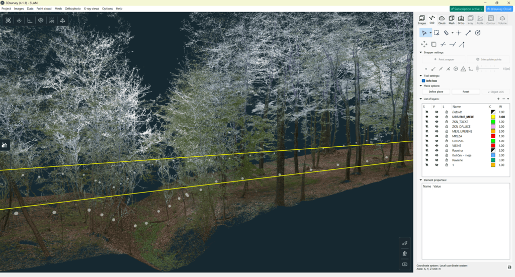
With a SLAM device, a single operator can perform the entire pre-survey while capturing significantly more detailed data for high-quality cadastral alignment. Since the operator walks directly beneath the forest canopy, the scan also captures tree trunks and surrounding terrain in great detail.
The result?
After processing the data back in the office, you can clearly determine which trees belong to which side of the parcel boundary, with a level of detail and efficiency that was previously difficult to achieve.
Join us and see how modern reality capture technology is changing forestry workflows.
Webinar details
Date: 11 June 2026
Time: 2pm – 3pm CEST
Platform: GoTo Webinar

