Drone photogrammetry was used to thoroughly map a house for renovation planning.
9 ground control points (GCPs), 20 façade control targets, and GNSS were used to ensure high accuracy.
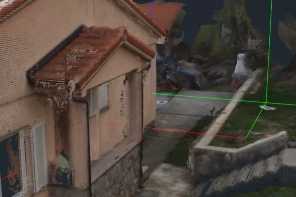
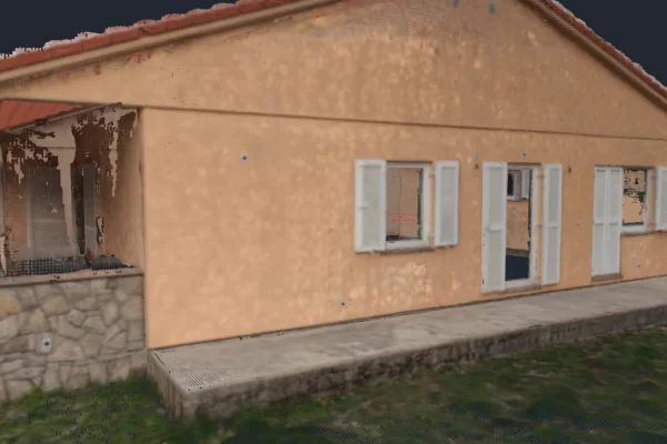
Two drone flights (high altitude + close-up) captured both the roof and façade details with strong overlap.
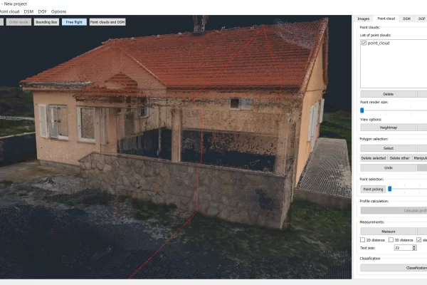
Over 560 images were processed to create a dense 3D point cloud, DSM, orthophoto, and height map.
All processing was done in 3Dsurvey — no need to export to other tools.
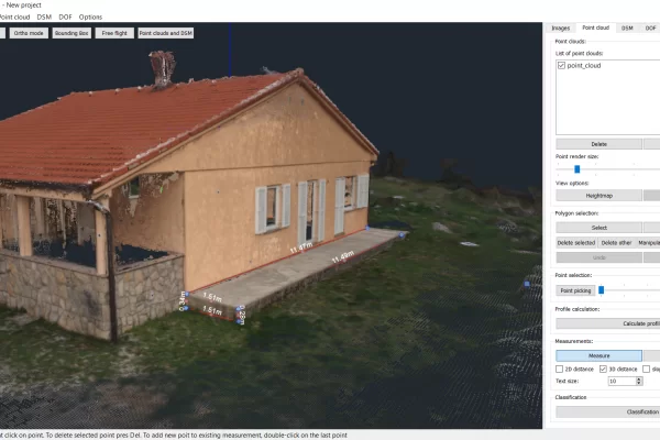
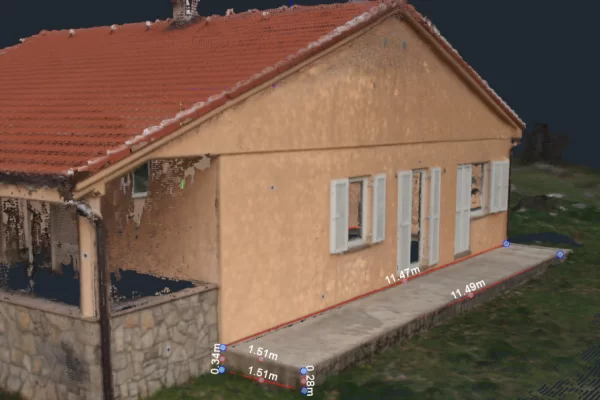
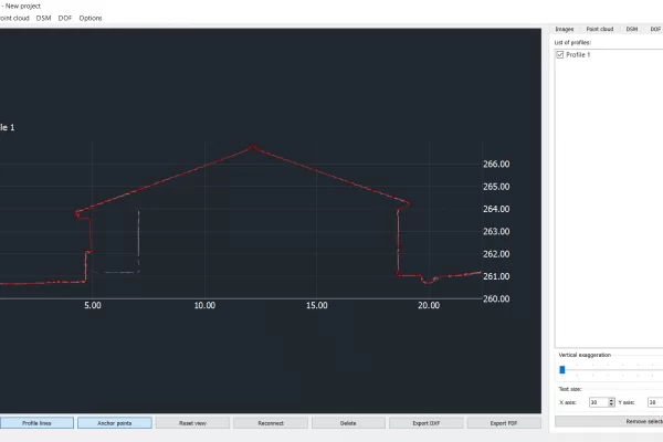
The data enabled architects and builders to perform accurate 3D measurements of structural issues.
Using 3Dsurvey the building permit documentation process was sped up 4× faster than traditional methods.
Introduction
Josip Došlin from a Croatian-based land surveying company Krešimir d.o.o. took on a 3D mapping project of a house to speed up the renovation process.
Project Description
How to 3D map a house and take all the measurements in one go? How to make it easier on architects and builders? Can we speed up the planning and design process and cut costs at the same time?
The main objective was to completely digitalise the data, create digital 3D models that are accurately orientated and fully measurable, and to provide the architect with the means for immediate cost calculation and building permit documentation design.
Data Acquisition
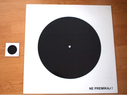
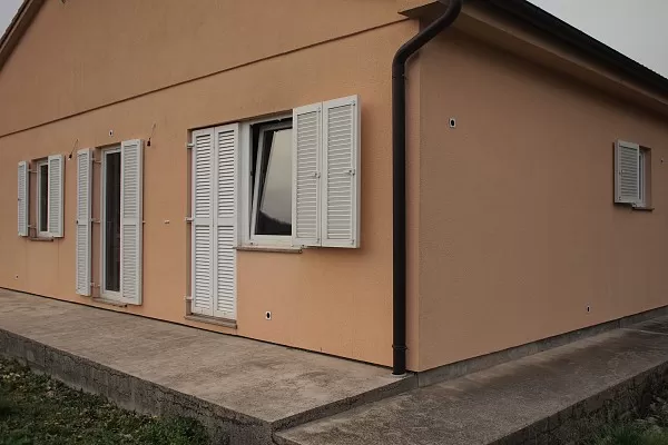
‘The devil is in the detail’ is very much a true idiom, especially in cases like this. Small-scale projects (family homes, small bridges, etc.) always require the most accurate data. Every window, corner, tile, or roof element is of high importance to the end result. High quality input images and positioning information are a great start towards making sure photogrammetric processing results are of survey-grade precision. To meet all these requirements a combination of ground control points (9x), facade control targets (20x) and GPS (3x) was used to get the best basis for spatial orientation.
3Dsurvey Ground Control Point Design
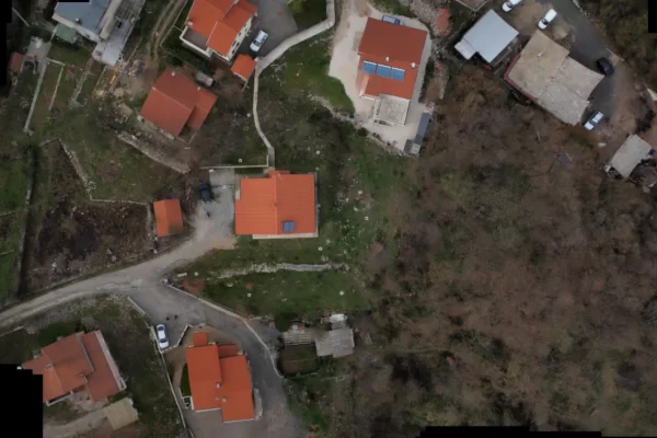
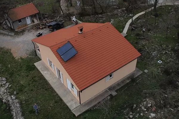
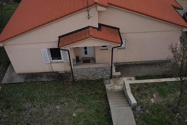
A rotary SurveyDrone01 was chosen for the 3D mapping as the surveyed area was compact and fairly close to neighbouring houses. Two flights were conducted for a total flying time of 30 minutes. The first flight was at 80m, mostly responsible for orthophoto generation and property allotment. The second flight was at different heights closer to the ground, needed to capture facades and roofing elements from different angles. Images were captured with Olympus EP2 with an 80% horizontal and 70% vertical overlap to ensure accurate generation of orthophoto and further 3D modelling.
Results
All processing tasks, from initial image processing, high-density 3D point cloud generation, orthophoto calculation, 3D modelling and rendering, 3D visualization and final exporting of project documentation was done using 3Dsurvey software.
The resolution and quality of the results far exceeded the architect’s requirements.
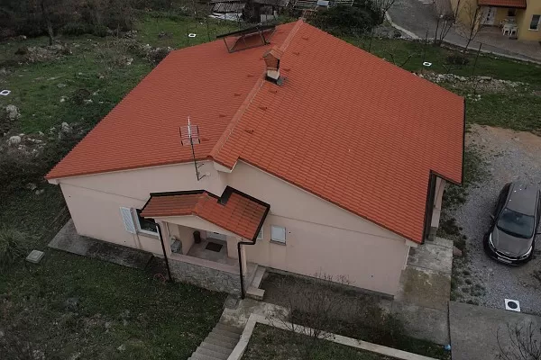
Orthophoto
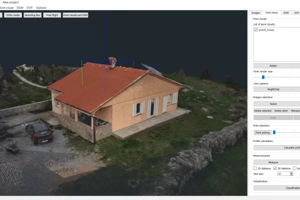
3D sketch
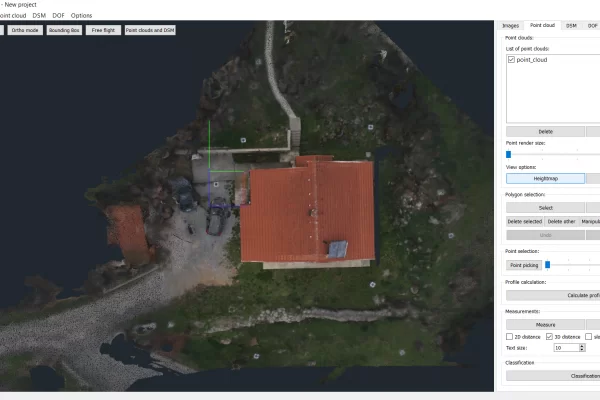
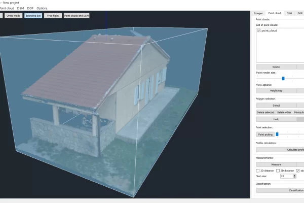
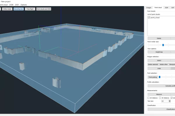
Point cloud
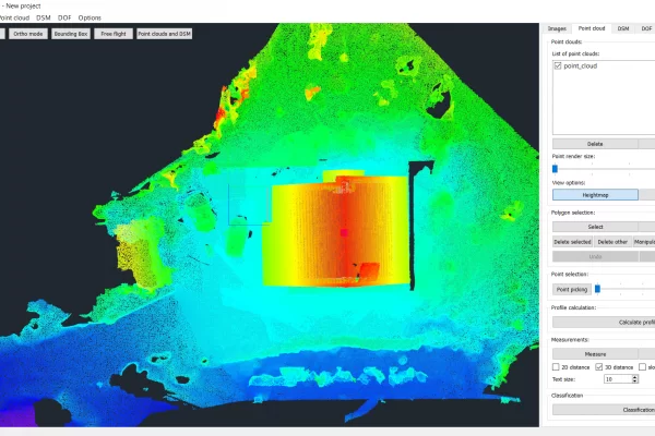
Heightmap
Point cloud top down
The following results were provided: a digital surface model (DSM), a generated point cloud for further data manipulation, a georeferenced orthophoto map in realistic colours, a height map to graphically indicate the levels of the plot as well as the house elements, and 3D measurements of the structural problems.
There was no need for exporting to GIS or CAD as all the tools and features are fully integrated within 3Dsurvey software. However, source files along with a project file were provided to the architect to help them speed up the design finalization and material detailing.
3D measurements
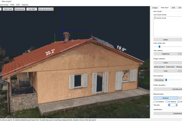
Slope measurements
Advantage of This New Technology
Drone-based 3D mapping and imaging is not a novelty any longer. That said, it is vital to understand that photogrammetric processing of drone-captured data and post-production of technically demanding documentation is a different story altogether. Ensuring accuracy, proper spatial orientation and high-precision 3D modelling is of paramount importance when it comes to professional land surveying services. And that’s where 3Dsurvey makes for a great software solution. The whole project was finished in one day with fully customizable and measurable 2D and 3D outputs helping the architect finish the building permit plans 4x faster.
Project Tools & Specs
Land surveying office: Krešimir d.o.o., Matulji, Croatia
Drone: SurveyDrone01 by Onedrone (2x 15-minute flights on 2 batteries)
Camera: Olympus EP 2
Positioning & Orientation: GPS used 3x for extra accurate orientation, 9x GCPs (40cm diameter), 20x facade control points (5cm diameter)