We’ll talk about the correct way of setting your ground control targets before the flight. We need them for accurate 3D data in order for 3Dsurvey to automatically process model orientation.
When you buy 3Dsurvey software you have the option to purchase 10 ground targets made from durable plastic to cope with your everyday tasks.
3Dsurvey ground targets
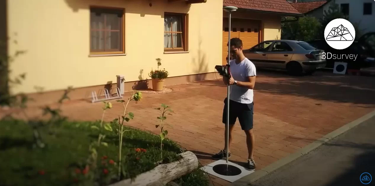
Measure GCPs with total station or GPS
It is very important to set the targets properly to achieve end results with land surveying accuracy. We recommend printing out a Google map of the area and assigning approximate spots of control targets before leaving the office.
Here are two rules to follow:
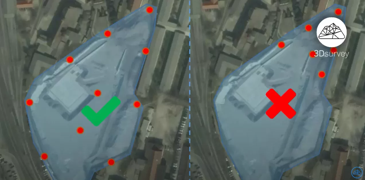
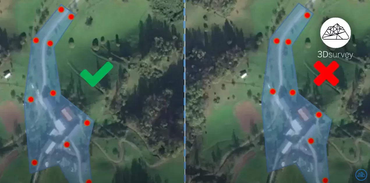
1. Try to place ground control targets as evenly spread as possible across the selected area.
2. Always make sure that your area is within the boundaries of ground control points. We have the area coloured in blue, the correct placement of ground control points is on the left and the incorrect on the right.
The minimum number of ground control points is 3, but you should always use more to have them serve as redundant measurements.
To finish, measure ground control targets with GPS or a total station and start your flight.


