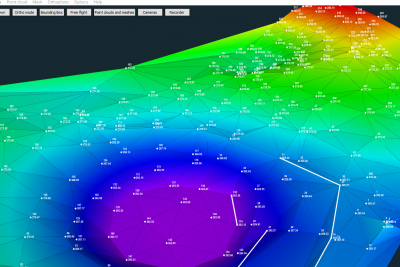
Surveying professionals are often challenged by different terrains and various project requirements. There are situations where photogrammetry data is not complete and traditional measurements needs to be done on the field, on the other hand some projects are using earlier surveying results based on traditional surveying methods and you want to add new photogrammetry data. How to combine both worlds into single 3D model? Vid will show you how you can do this with the help of 3Dsurvey new simple feature called breakline support.
Photogrammetry and traditional measurement results in one 3D model
Facebook
X
LinkedIn
Subscribe to our newsletter
What’s new in the field? Stay up to date with our newsletter!

