Key takeaways
Used drone photogrammetry to capture high‑resolution imagery for cadastral boundary mapping.
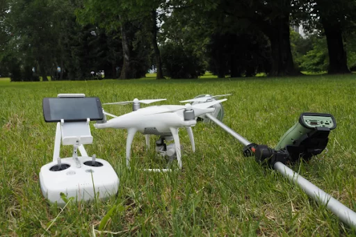
Conducted a 7-minute flight with a DJI Phantom 4 over a 250 × 350 m plot.
Placed 7 ground control points (GCPs) and 8 independent validation points for precise geo-referencing.
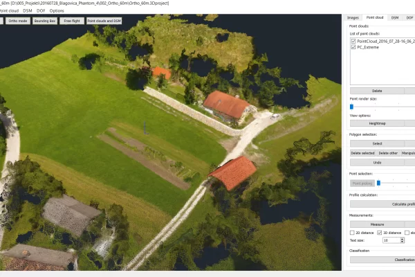
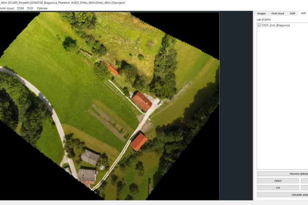
Generated a 3D point cloud and orthophoto in 3Dsurvey, then overlaid existing cadastral data.
Achieved 2-cm accuracy, significantly better than typical cadastral accuracy.
Completed the entire project in just 4 hours — nearly twice as fast as traditional boundary surveying.
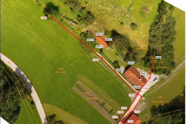
Provided high-quality, geo-referenced boundary data to update or regularize cadastral maps.
Advantages: Saves fieldwork, improves data quality, and offers scalable, efficient boundary mapping.
Introduction
The fusion of spatial technologies and the emergence of affordable platforms to carry these technologies has opened up new opportunities for mapping and modelling cadastral boundaries. High resolution imagery from UAS can now be used to optimize the amount of fieldwork required and offers a more efficient and richer solution for defining property boundaries.
This case focuses on the UAS-based methodology for producing precise geo-referenced boundary data that can be used to update or regularize existing cadastral data. We outline the methodology in terms of (a) field work (including pre-marking, geodetic and ground control, flying), and (b) post-field processing (production of orthophotos and 3D models, quality control and assessment).
Data Acquisition
This small plot of land in Blagovica (250m x 350m) required a single 7-min flight at 60m AGL for which one battery was more than sufficient. DJI Phantom 4 will fly up to 28-mins on a single battery in ideal conditions. To ensure accuracy of 1-4cm we used 7x GCPs and additional 8x independent validation points for later post processing and error assessment. Usually the cadastre accuracy is 20cm in urban areas and 5m in forests and rural areas.
Capturing 64 images with 70% overlap (lateral and forward) was enough to get the whole plot properly mapped. This includes adjoining parcels, roads, woods, and other objects. The amount and level of detail that we were able to acquire with a single 7-min flight was superb. Phantom 4 integrated GPS (EXIF data for each image) would most probably be enough to achieve satisfactory geo-referencing in this particular case. However, to really make sure it was as accurate as possible we put extra GCPs and validation points in place.
Results
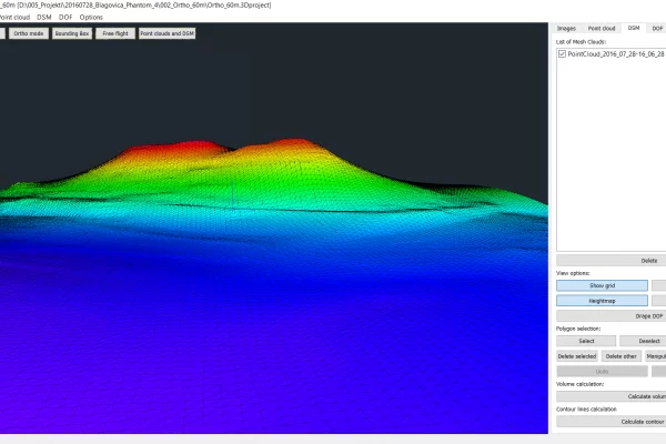
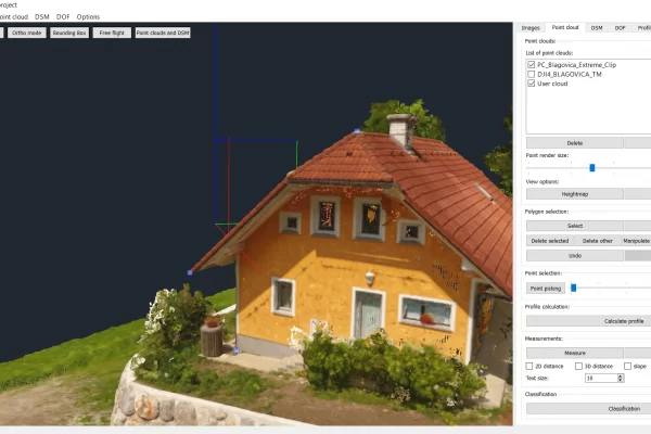
Photo alignment produces relative camera coordinates, a camera calibration for each and every image as well as a sparse point cloud. For low accuracy requirements this may be all that is required to calculate an orthophoto or a model if the final product does not have to be referenced to some spatial reference frame. However, the process of determining the camera positions is significantly accelerated if approximate positions are introduced into the photo alignment procedure. Typically, these approximate positions are obtained from the stand-alone navigation GPS receiver mounted on the UAV. However, if the product is to be accurately geo-referenced to a defined coordinate system (e.g. WGS84/UTM), then GCPs need to be provided.
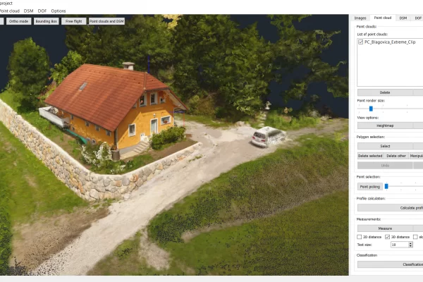
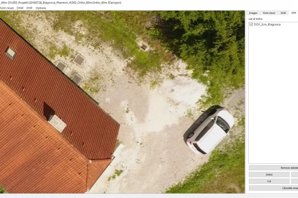
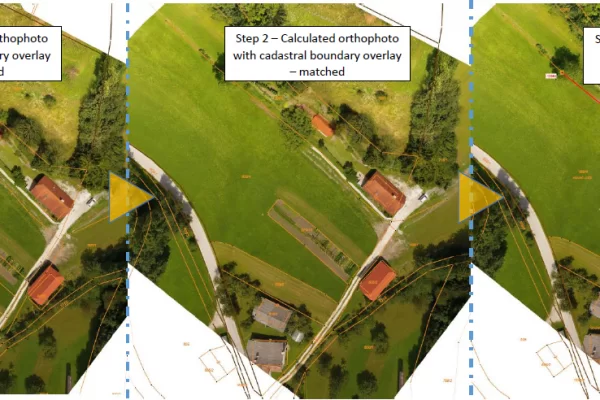
Upon generating 3D point cloud and calculating an orthophoto in 3Dsurvey, a local (country-specific) database was used for sourcing original cadastral documentation and pairing (overlaying) it with the digital orthophoto map. The point cloud and orthophoto act as the basis for cadastral boundaries corrections and re-alignments.
We achieved a 2-cm accuracy, well below what had been expected. The whole project took 4 hours. This is nearly twice as fast as classical methods usually take, with the benefit of highly improved data quality and quantity.
DJI Phantom 4 and 3Dsurvey geospatial accuracy tested. Ideal for small to mid-size projects >
Find below the images that show generated 3Dsurvey outputs and finalized cadastral boundary documents.
Advantages of using a Drone and 3Dsurvey for Mapping and Processing Cadastral Boundaries
No longer is manual fieldwork and classical measuring the most efficient and accurate way of spatial data acquisition for cadastral boundaries mapping. Speed, cost-efficiency, data quality and quantity, ability to do everything in one go with no need to revisit the site, ease-of-use and scalability in terms of applying the same process and technology to large-scale projects, stand as enormous benefits to any surveyor. Add to this a whole lot of customizable results and extremely accurate, visually appealing outputs with more information any professional could ever want, and the advantages get pretty self-explanatory.
Project Tools & Specs
- Drone & Software: DJI Phantom 4 + 3Dsurvey
- Flight details: Single 7-min flight at 60m AGL
- Camera: Integrated DJI w/ embedded rolling shutter
- Positioning & Orientation: Integrated GPS (EXIF data), 7x ground control points, 8x independent validation points
- Photogrammetric processing & Outputs: 3Dsurvey software
- Number of Images: 64
- Area size: 250m x 350m
Keen to test 3Dsurvey for your own mapping and modelling of cadastral boundaries? Try it free for 14 days. Click here.

