Key takeaways
Drone photogrammetry enabled efficient cadastral measurement of building outlines with aerial data.
Ground control points (GCPs) were used to precisely georeference the aerial imagery.
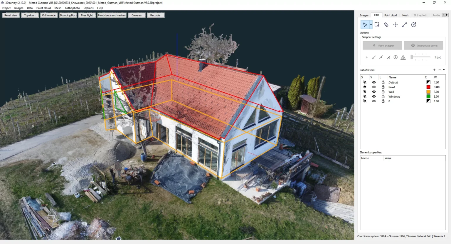
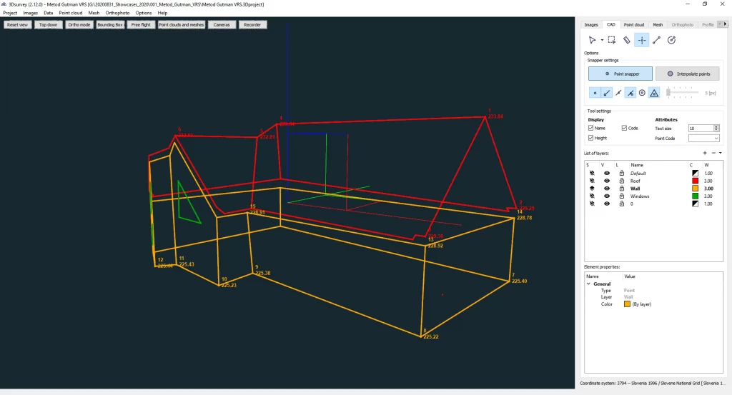
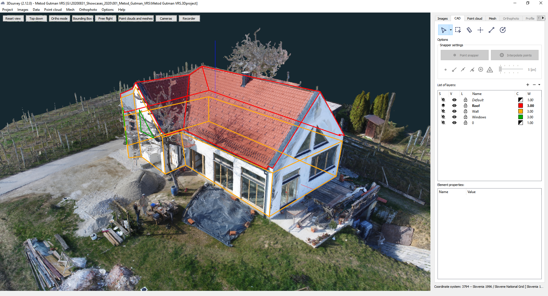
3Dsurvey’s CAD module allowed drawing building outlines directly on the 3D model with millimeter precision.
Tools like height-lock, perpendicular/parallel snapping, and drawing planes sped up the workflow.
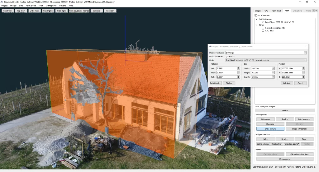
Generated vector outlines (DXF) could be exported directly for cadastral or GIS use.
The workflow significantly reduced time and cost compared to traditional cadastral surveying methods.
Introduction
Manual fieldwork and classical measuring are no longer the most efficient and accurate way of spatial data acquisition for cadastral boundaries mapping.
Speed, cost-efficiency, data quality and quantity, ability to do everything in one go, no need to revisit the site, ease-of-use, and scalability in terms of applying the same process and technology to large-scale projects – all of these stand as enormous benefits of drone mapping to any surveyor. Add to this a whole lot of customizable results and extremely accurate, visually appealing outputs with more information any professional could ever want, and the advantages get pretty self-explanatory.
Overview
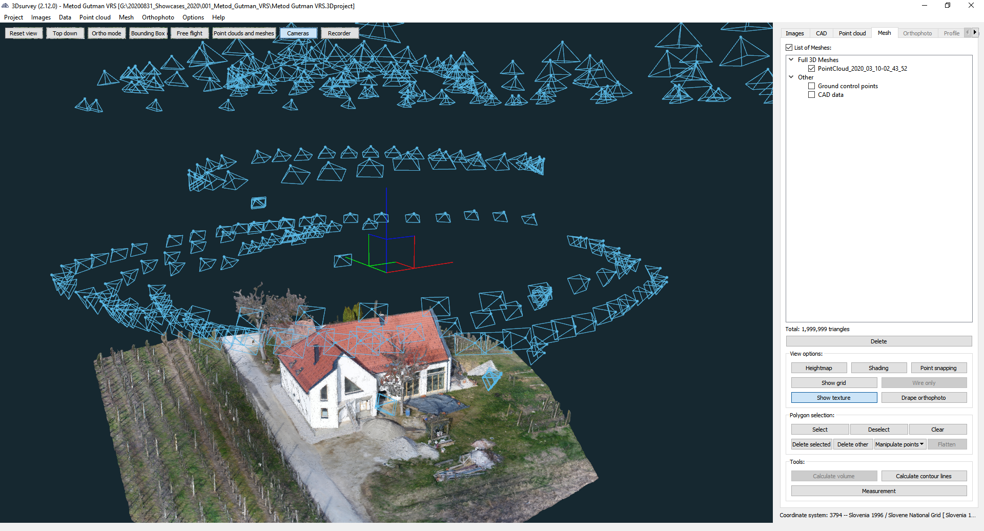
For this project, Metod Gutman did measurements for the entry of the building in the cadastre. It is necessary to measure the corners of the building, the position of the roof (stroke, ridge, slope), the lowest point of the terrain and the building inside.
The vast majority of this data can now be obtained using a drone.
Surveying with a drone offers enormous potential to GIS professionals. It is possible to carry out topographic surveys of the same quality as the highly accurate measurements collected by traditional methods, but in a fraction of the time. This substantially reduces the cost of a site survey and the workload of specialists in the field.
With PPK geo-tagging, you also save time, as placing numerous GCPs is no longer necessary. You ultimately deliver your survey results faster and at a lower cost.
Project tools and specs
- Drone: DJI Phantom 4 PRO
- Camera: onboard, 350 images
- Flight plan: 1x grid flight and 3x circle flights
- Number of gcps: 5
- Area of interest: 100 x 100m
- Location: Prekmurje, Slovenija
- Date: March 2020

