Drones and LiDAR are the new industry standards for field speed and high precision.
Accurate surface data prevents costly construction errors and design clashes.
Modern workflows prioritize seamless data extraction, DEM generation and CAD deliverables.
3Dsurvey provides an all-in-one environment to process, clean, and vectorize your field data.
Introduction
If you want to avoid costly earthwork miscalculations and site delays, mastering a topographic survey is non-negotiable.
We have all been there, trudging through mud with a total station, wasting hours capturing points manually. Modern projects demand faster, smarter workflows to keep margins intact. Today, combining robust field tactics with intelligent software is the only way to stay competitive.
If you are not sure of everything it takes to do a land surveying project check out our Land surveying 101 blog.
What is a topographic survey?
A topographic survey is a highly precise map of the physical world. It captures the exact terrain and every natural or man-made feature sitting on top of it.
In the field, you record:
elevations,
contours,
the exact positions of structures,
vegetation,
and utilities.
This creates a reliable snapshot of the existing ground conditions. For surveyors, engineers and architects, this data is the ultimate project baseline. It lets you foresee design challenges, calculate earthworks, and adapt site plans before a single excavator hits the dirt.
What information does a topographic survey include?
Topographic survey delivers a comprehensive surface map. It captures elevation changes, contours, and the location of natural elements such as trees and vegetation, alongside manmade features like roads, buildings, and fences.
The survey does not cover underground or hidden features, as it focuses on visible surface characteristics.
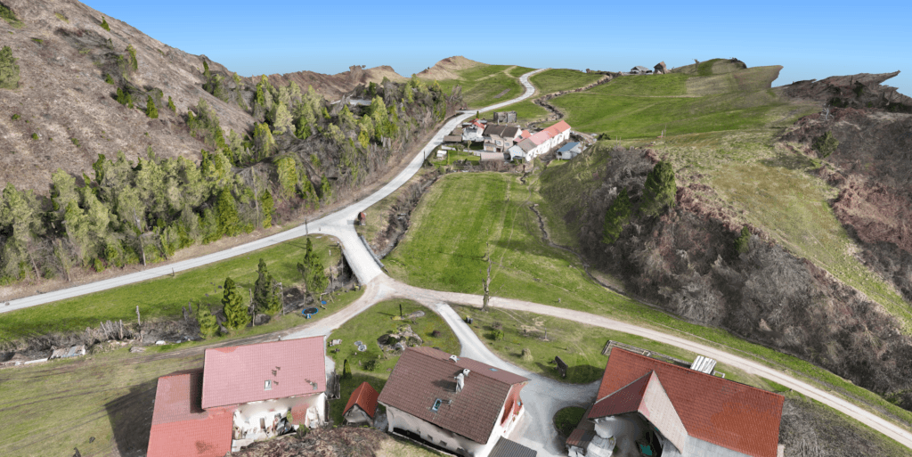
Digital surface model containing both natural elements and man-made features as a result of a topographic survey.
How is a topographic survey conducted?
Traditional surveying relied entirely on total stations and GPS rovers. While precise, manually walking a grid is incredibly slow, labour-intensive, and limits your daily coverage.
Today, surveyors capture sites using drones (UAVs) and SLAM LiDAR devices. Drones fly pre-programmed grids to capture thousands of high-resolution, overlapping aerial images in minutes. For indoor mapping or heavily vegetated areas, handheld SLAM scanners step in. You process data of each of these methods into dense point clouds, DEM-s and orthophotos, transforming days of field work into hours of office processing.
Drone pilot operating a drone, to capture a building.
How accurate is a topographic survey?
Ground-based tools offer millimeter precision but sacrifice significant field time.
Modern drone photogrammetry and SLAM LiDAR devices achieve 1-2 cm accuracy, which is perfect for standard earthwork and planning. Drones excel on large, open sites but depend on good weather and strict flight permissions. LiDAR shines exactly where drones struggle, under dense tree canopies or inside complex structures.
Ultimately, your accuracy depends on sensor quality, flight altitude, and a tight network of ground control points (GCPs).
Top 3 benefits of a topographic survey
1. Informed planning
Accurate elevation data lets you design structures that naturally fit the terrain. You avoid design clashes and maximize the usable land area.
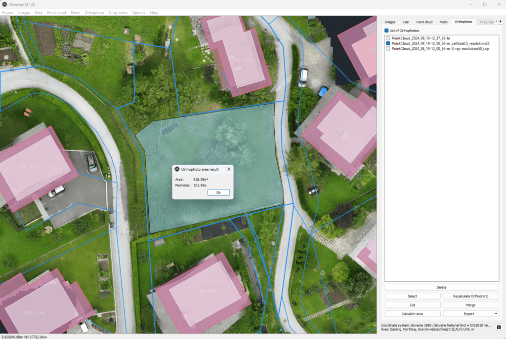
Orthophoto featuring CAD linework and computed area values in 3Dsurvey.
2. Risk and cost reduction
Upfront field data reduces confusion, eliminating expensive rework and keeping the project moving safely.
3. Unmatched visualization
Detailed 3D models and orthophotos instantly communicate site conditions to your clients. You can rapidly calculate cut and fill volumes and pull cross-sections to back up your contractor billing.
The 3Dsurvey advantage
You do not need five different software licenses to process your data. 3Dsurvey handles the entire workflow, from raw drone images to final engineering deliverables.
You can effortlessly clean noisy point clouds, draw precise CAD data, and calculate stockpile volumes in just a few clicks.
It bridges the gap between field capture and the drafting room. You get seamless CAD integration and professional volume reports without the usual processing headache.
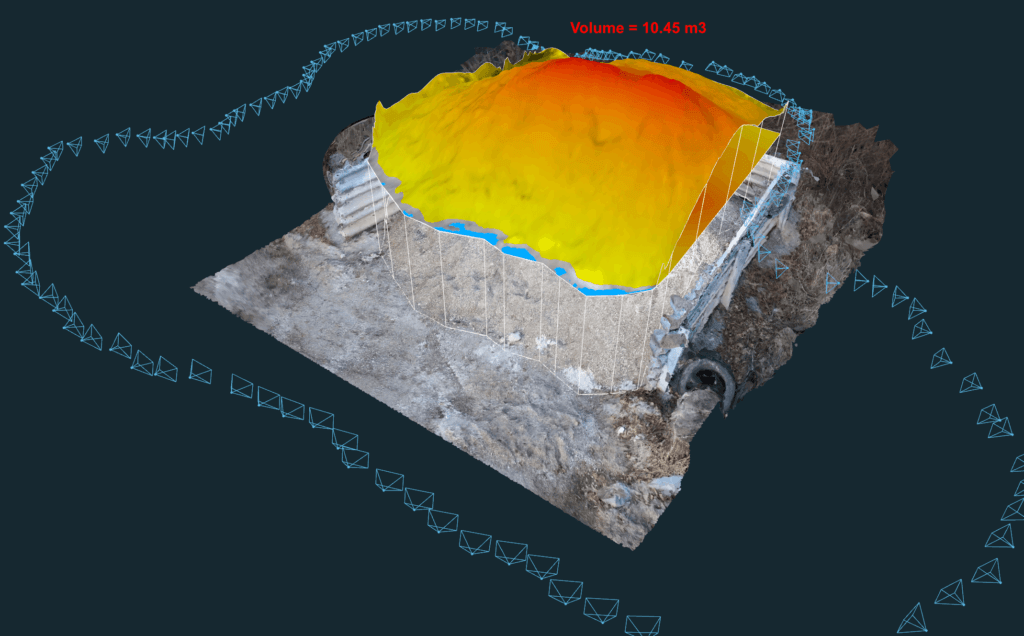
Precise volume calculation of a stockpile, calculated with 3Dsurvey.
Conclusion
A reliable topographic survey is the foundation of every successful construction project. It replaces guesswork with hard data and measurable terrain models.
Drones and LiDAR are not risky new technologies, but proven, highly accurate industry standards for modern land surveyors and construction professionals.
Ready to streamline your workflow and extract perfect CAD data? Start your 14-day free trial of 3Dsurvey today and take full control of your field data.