LiDAR, photogrammetry and GNSS were combined to create a highly accurate topographical survey of the proposed reservoir site.
Merging LiDAR and GNSS data improved terrain accuracy by capturing features hidden beneath dense vegetation.
Height maps, contour lines and point grids enabled detailed terrain analysis and better visualisation of depressions and slopes.
Integrated CAD tools simplified the creation of 3D maps, infrastructure mapping and terrain measurements within a single workflow.
Volume and profile calculations helped assess reservoir capacity and identify potential overflow points.
The entire workflow—from data import and processing to analysis, reporting and cloud sharing — was completed in 3Dsurvey without switching between multiple software packages.
Introduction
The climate is changing, and there are many examples to support this. Some of the consequences can be particularly dangerous and it is becoming more and more difficult to avoid sudden changes in weather conditions. Topographical surveying can help prevent natural disasters that come from this sudden changes. If you want to read more about What a topographic survey is, read our blog.
The risk of flooding, like wildfires, is one of the most frightening natural disasters. The difference is that a wildfire can break out in a matter of seconds and for many reasons, whilst a flood can usually be predicted several days in advance.
During a flood, excess water must be stored somewhere, and this is precisely the primary purpose of reservoirs.
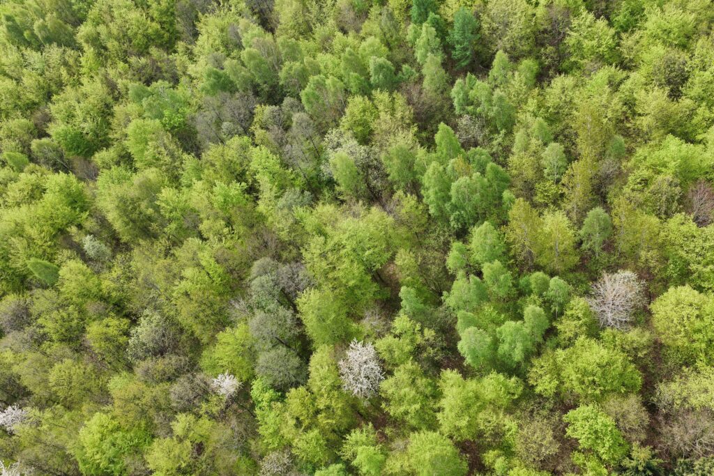
The Geos3D team recently carried out surveys of the site designated for the construction of a reservoir. It is a wooded, depressed area, ideal for this project.
Fieldwork
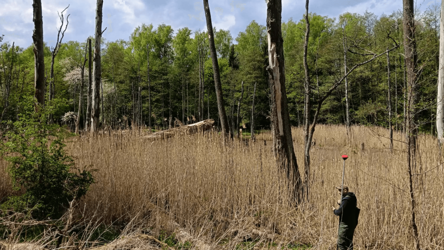
LiDAR technology using a drone was employed for the surveys. A dense point cloud enabled the surveyors to capture the actual topography of the terrain. Photogrammetry was also carried out, as well as direct measurements using a GNSS receiver.
The fieldwork lasted the whole day. The operations using the DJI Matrice 350RTK drone took up the most time. It was also important to survey all existing hydrotechnical infrastructure, which sometimes was under the trees and LiDAR could not reflect properly. That is why it was necessary to use the GNSS receiver.
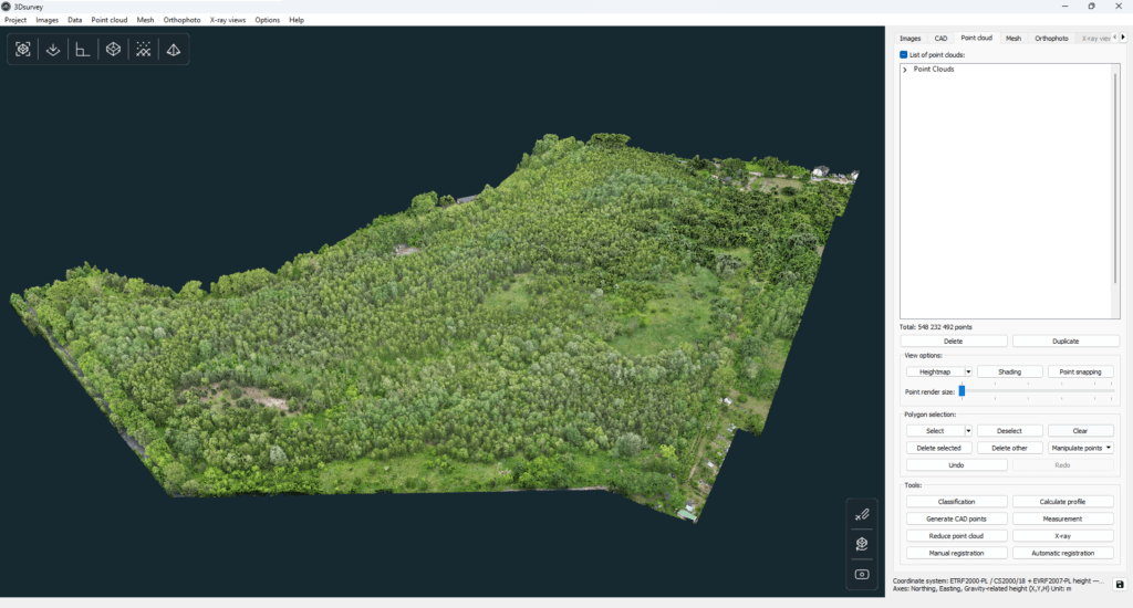
LiDAR data imported into 3Dsurvey from the drone.
Post-processing
After an exhausting day spent outdoors, the next few days in the office began.
The process was complex. Everything was carried out using 3Dsurvey software.
The first step was to import the data, then classification. The extracted terrain class revealed certain details, but this was not enough.
A quick preliminary analysis – following the creation of a digital surface model – showed that it was necessary to supplement the data with additional points derived from GNSS surveys.
These were imported into the 3Dsurvey software in .XYZ format as a point cloud. This enabled the surveyors to add further points and complete the original LiDAR point cloud.
After merging all the data into a single point cloud, the resulting digital surface model (DSM) was significantly more detailed.
This hybrid method is ideal for this type of work. The lesser known capabilities of this software are truly game-changing.
The next stage of the analysis involved marking out all existing infrastructure and creating a 3D map. This is a very simple method, involving the merging of points from direct surveys with points from the point cloud.
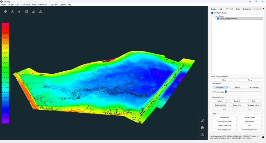
Heightmap view in 3Dsurvey.
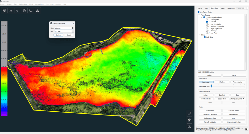
For this type of terrain, the best option is to use the height map view. You can set the range yourself, which is a major advantage. When set to a short range, every depression was more clearly visible.
Adjusted range to ensure better visibility.
Some measurements were also taken in the CAD tab. The slopes of the terrain and the road were marked.
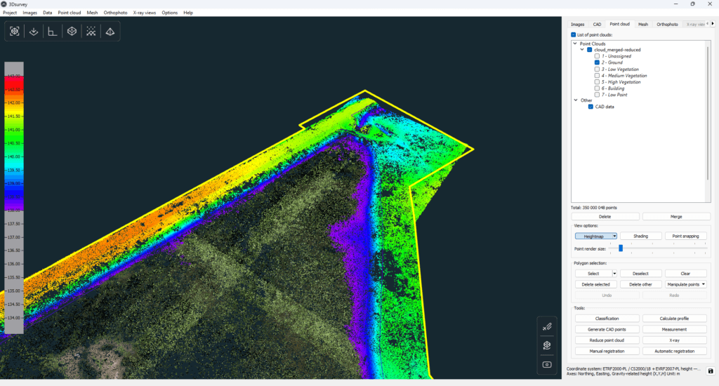
Another range adjustment.
The project was also improved thanks to the regular creation of a point grid (and its manual adjustment). This is a time-saving option that has a huge impact on the workflow.
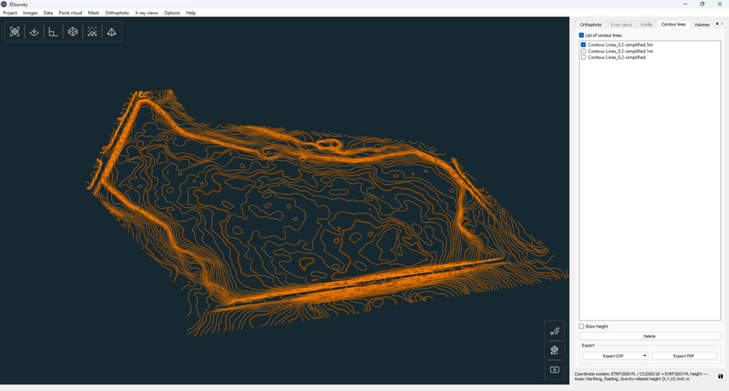
Another suggested solution was to create contour lines. Thanks to the merged point cloud (containing points from direct surveys) the culverts and the rest of the infrastructure were mapped much more accurately. The spacing between points was set at 5m.
Contour lines in 3Dsurvey.
Additionally, volume calculations were carried out. This tool is ideal for estimating the point at which water will breach the embankment.
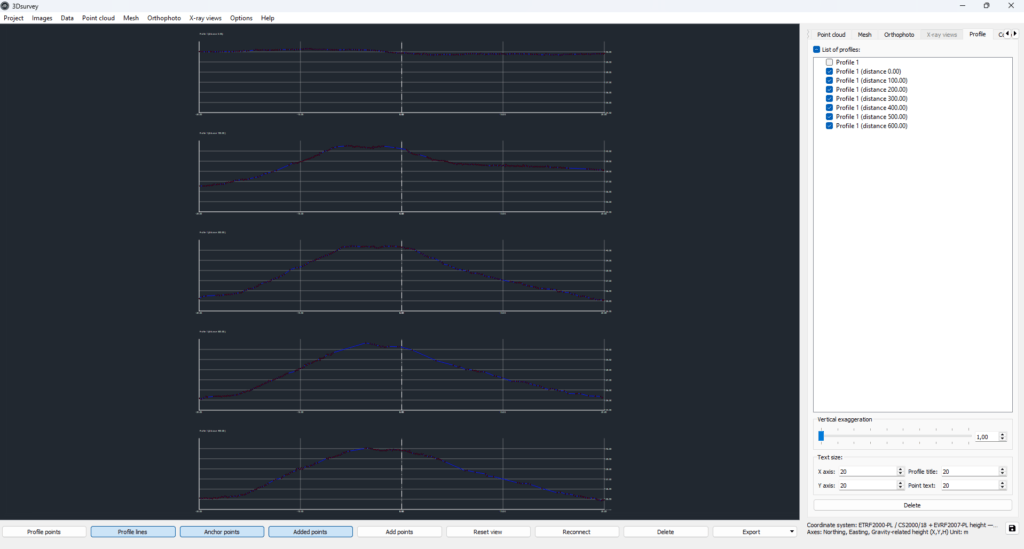
The last step were also the profile calculations on the embankment. They were, of course, also done in 3Dsurvey software. Another easy-to-use method to obtain high quality profile lines automatically.
Profile calculations.
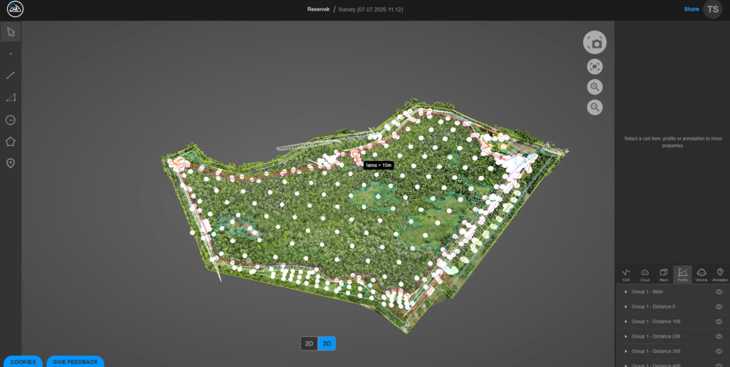
The entire project was delivered to the client via the 3Dsurvey Cloud. Recently, the contour lines were also added to the cloud viewer, which is another nice feature for the client.
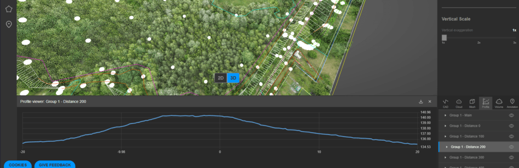
Profiles in the 3Dsurvey Cloud viewer.
Profiles in the 3Dsurvey Cloud viewer.
Conclusion
The real complex analysis was done in 3Dsurvey software, which again did not disappoint. This is a genuine and powerful tool to provide many things within one platform. The various calculations and options are available and easy to manage.
If you want to see 3Dsurvey perform for yourself, startour 14-day free trial today.