Key Takeaways
- Upfront software price rarely reflects the true total cost of ownership in the field.
- Hidden cloud processing fees and feature paywalls can wreck your project budget.
- Fast and expert support is essential to resolve software issues quickly and keep your projects on schedule.
- Perpetual licenses provide ultimate data security and long-term value over endless subscription rentals.
Introduction
When you’re dealing with mud, tight deadlines, and demanding clients, the last thing you need is a software bill that suddenly triples.
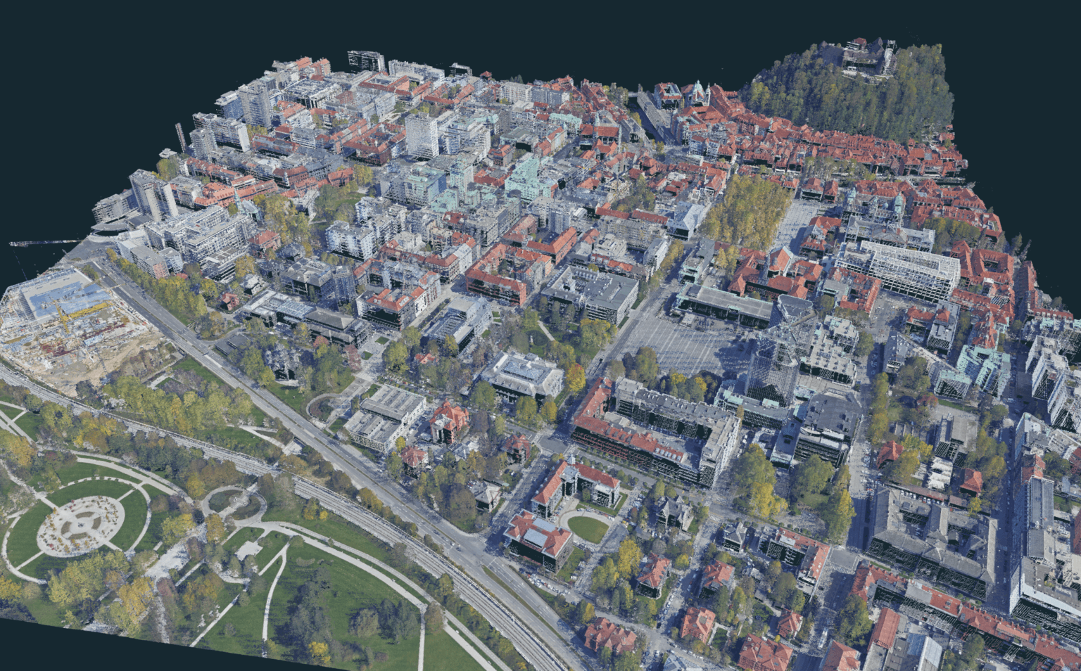
Between runaway cloud processing fees and lingering questions about the security of your uploaded project data, finding the right tool can feel like navigating a minefield. That is why choosing affordable photogrammetry software with 3D modeling features is about much more than just finding the lowest initial price tag.
You need a solution that actually works when you sit down to process. The real cost of photogrammetry software includes your time, your data control, and the peace of mind knowing you won’t be charged extra just to export a clean point cloud. Let’s break down what affordability actually means in the surveying business.
Why cheap often costs more than you think
A low entry price is usually a bait. Professional surveying and 3D modeling require heavy lifting, and software companies know exactly where to hide the real costs once you are committed to their ecosystem.
Image limits per project
Your initial license might be cheap, but many budget options cap the number of images you can process. When you fly a massive corridor and come back with thousands of high-res photos, those limits force you into expensive, sudden upgrades.
Cloud processing fees
Cloud processing is great for smaller projects but can be a nightmare when used at scale. You are essentially paying for server time. Every time you re-process a dataset or tweak a parameter, the meter keeps running. This can make smaller projects pretty cheap, but the prices can skyrocket when processing a bigger dataset.
Data security
Before buying a certain license option, it is very important to know what kind of data you are working with. For sensitive infrastructure or mining projects, handing your data over to a third-party server can be a pretty big liability, while offline desktop processing ensures your data stays exactly where it belongs, on your hard drive.
Feature paywalls
Many software programs frequently exclude essential 3D modeling features like point clouds, mesh generation, and CAD tools from their basic version. This turns a low introductory price into a much higher final cost just to secure a fully functional workflow.
The importance of technical support
Technical support is an essential requirement for professional photogrammetry. When software issues arise during processing, you need immediate answers to keep your project moving and meet your deadlines.
- Response Time: You need a vendor that responds quickly to calls or direct emails, rather than routing you through automated chatbots.
- Technical Expertise: Support staff must be fellow professionals in the field you are working in. This is rare and extremely valuable, so when looking for the best affordable photogrammetry software with 3D modeling features, absolutely pay a lot of attention to what kind of support they provide.
Real affordability means having top-tier support included, so you can solve problems fast and get back to billing hours instead of losing them.
Renting vs. owning access to your data
We live in a world where tech giants try to rent us everything (subscription paying model).
Just like how you never truly own your streaming movies or cloud storage or the music you listen to, the industry has pushed hard toward the subscription model.
License models
- The subscription: This is the corporate standard now. You pay a monthly or annual fee. It might be good if you only plan to use the software for a smaller amount of time, but bear in mind, if you stop paying, you will lose access to your data.
- Perpetual Licenses: You buy the software, and you own that version forever. It might cost more on day one, but over five years, the savings can be massive. You dictate when to upgrade, not the vendor.
At 3Dsurvey we offer both options, so you can decide what is the right decision for you.
License price benchmark
To get a clearer picture of the market, here is a breakdown of how some of the biggest companies in the business stack up regarding pricing and licensing structures.
Software | Perpetual License | Monthly Subscription | Yearly Subscription |
Pix4Dmatic | / | € 374.17 | € 4,490 |
Virtual Surveyer (Peak) | / | € 245 | € 2,450 |
DJI Terra (Standard) | € 5,860 | / | / |
3Dsurvey | € 3,399 | € 225 | € 2,250 |
Note: Prices were looked up in March 2026.
Why is 3Dsurvey the most affordable photogrammetry software with 3d modeling features
When calculating the total cost of ownership, from licensing to processing, to support, 3Dsurvey is the most affordable. Designed specifically for the needs of land surveyors it involves all the tools needed for the deliverables. It also has:
- Pricing options that make sense: Flexible subscriptions are available for those scaling up, alongside traditional perpetual licenses for those who prefer to buy the software once and own it forever.
- Best-in-industry support: Technical assistance is provided by actual land surveyors rather than script readers. Support staff can look directly at project files. This high-level expertise is extremely rare, which is way our support is often named as the best support in the industry.
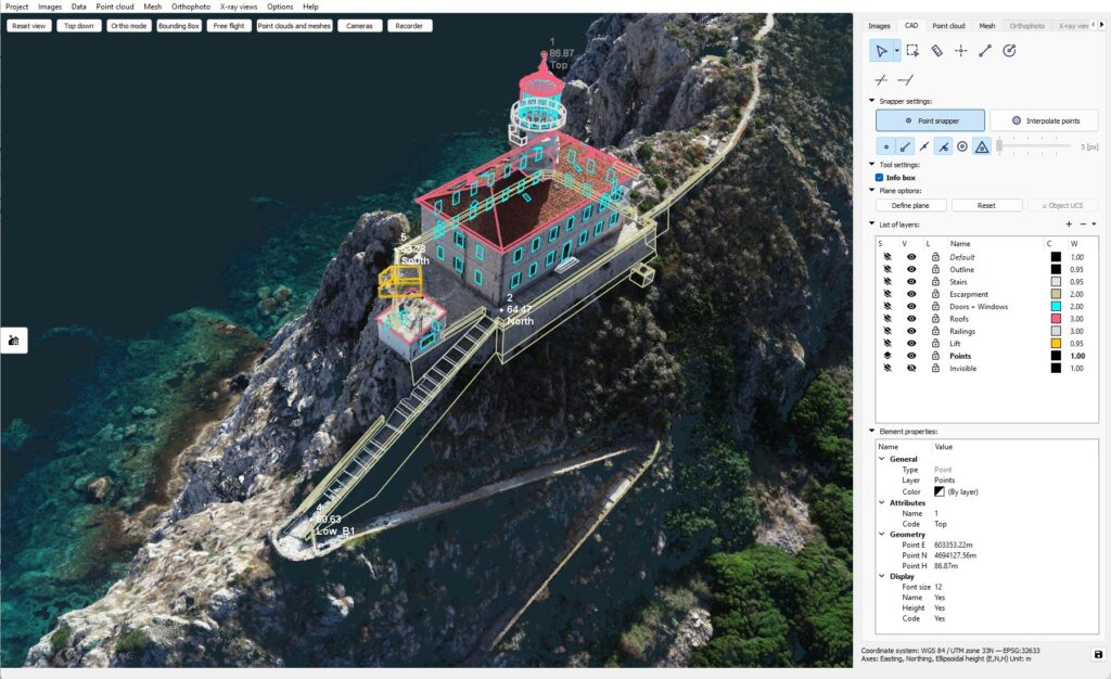
- All-in-one workflow: There is no need for a separate CAD program to do basic line work or volume calculations. All the tools for point cloud cleaning, vectorization, and volume measurements are built directly into the core engine. There is also no limit on how much projects you can make or how many images include.
- Complete data security: Because it runs locally, sensitive project data never leaves the office or gets uploaded to third-party servers.
Conclusion
Finding affordable photogrammetry software with 3D modeling features isn’t just about looking for the cheapest option on a pricing page. It is about getting all the features you will need, total control over your field data, avoiding seemingly endless cloud fees, and partnering with a company that will actually pick up the phone when you need them.
Focus on your work, not your software bill. Try the 14-day free trial of 3Dsurvey today and see it for yourself.
Not yet convinced? Read more about why 3Dsurvey is the best photogrammetry software in 2026, because we have more to say.

