The Pragmatic Guide to RTK Videogrammetry vs. SLAM Scanning
Key takeaways
RTK Videogrammetry dominates long, linear outdoor sites like excavation trenches and installations.
SLAM LiDAR excels in GNSS-denied, poorly lit indoor environments like tunnels and warehouses.
Both methods deliver centimeter-level accuracy where drone flights are legally or physically blocked.
You can process and clean both datasets effortlessly in a single workspace using 3Dsurvey.
Introduction
Let’s be honest: not every site is a clean, open field where you can just launch a drone. In many cases, you are dodging active excavators, working in no-fly zones, or mapping a dark, GNSS-denied warehouse.
In these situations, RTKvideogrammetry and SLAM (Simultaneous Localization and Mapping) become your best friends. They keep your boots on the ground while capturing reality at walking speed.
Both methods bypass flight restrictions and deliver reliable accuracy. But if you grab the wrong tool for the job, you will spend hours cleaning garbage data in the office. Here is how to choose wisely.
When to deploy RTK Videogrammetry in the field?
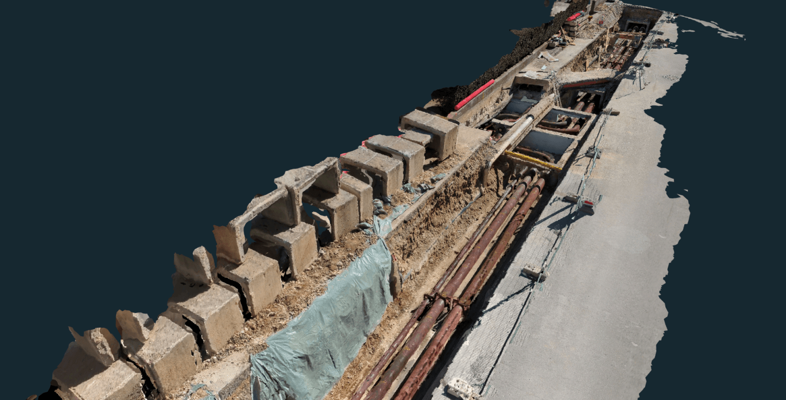
RTK Videogrammetry is fast, budget-friendly, and highly effective for outdoor, linear infrastructure. Think electrical installations, heating pipelines, and open sewage trenches.
All the hardware you need is a smartphone and a small antenna for RTK corrections. You simply walk the site, capture smooth video, and extract frames to build your point cloud. Hardware costs stay incredibly low compared to SLAM devices or laser scanning.
But it is not a silver bullet. The technique struggles with strong shadows and highly reflective surfaces. It thrives on good, even lighting and clear textures.
Indoors, this technique is also suboptimal. It lacks an RTK connection, and large featureless walls are difficult for the software to process, likely resulting in a point cloud full of holes.
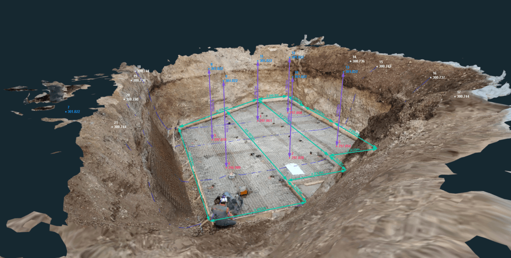
Excavation for underground fuel tanks documented using RTK videogrammetry and processed in 3Dsurvey.
Why SLAM LiDAR owns the indoors?
When lighting drops and satellite signals vanish, SLAM steps up. It is the absolute go-to method for indoor buildings, tunnels, and complex industrial facilities.
Unlike camera-based methods, SLAM uses active laser pulses. It does not care about poor lighting, repetitive geometry, or motion blur. You walk, and the scanner builds a continuous, reliable point cloud.
That said, SLAM represents a considerably heavier financial commitment than a standard RTK videogrammetry setup. If you are currently comparing scanners, we have also had 7 SLAM scanners put to the test, where we present and benchmark seven popular options side by side so you don’t have to.
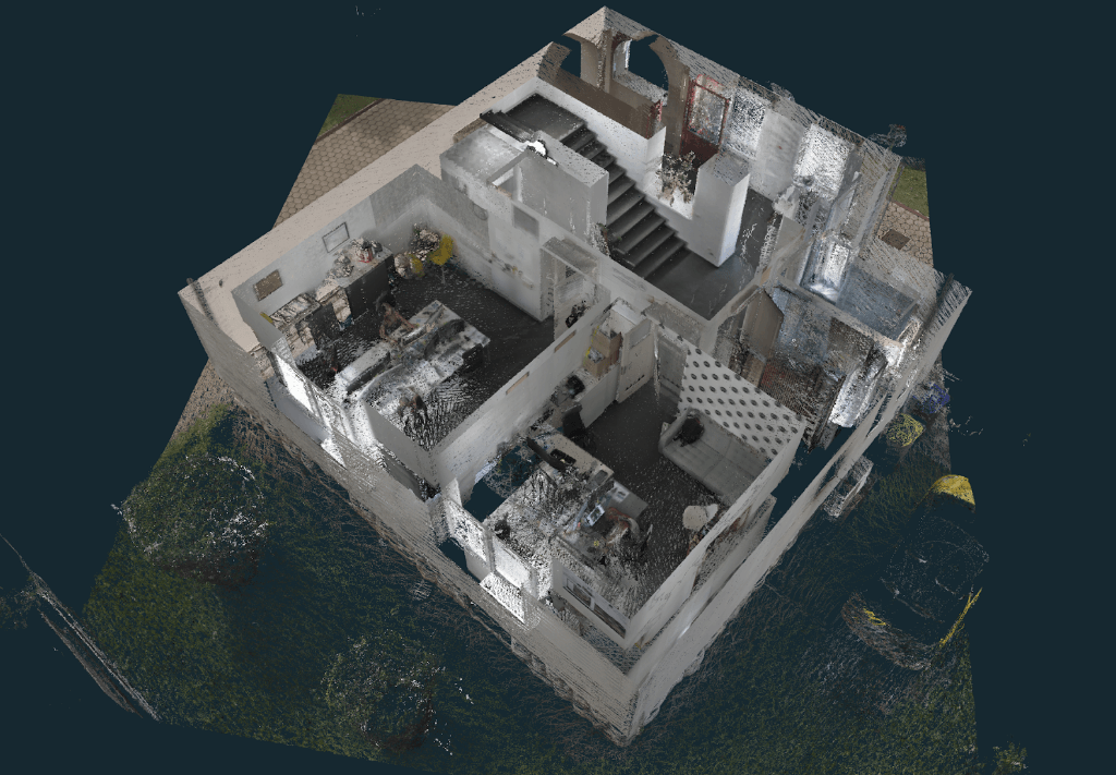
Building captured with a SLAM LiDAR scanner and processed in 3Dsurvey.
Ground-level alternatives when drones are grounded
Both technologies shine when drones are out of the question. Whether restricted by aviation law or blocked by dense tree cover, you need ground alternatives.
If you need to document an urban corridor where airspace is restricted, both RTK videogrammetry and handheld SLAM LiDAR keep the project moving.
The goal is always the same: capture the data fast, get out of the mud, and achieve centimeter-level accuracy.
Processing both worlds in the 3Dsurvey workspace
You do not need to buy separate, expensive software packages for different field tools. 3Dsurvey handles the heavy lifting for both of these workflows.
With videogrammetry you just import your videos. Our engine will automatically extract the optimal frames and generate a centimeter-level accurate dense point cloud and mesh.
With SLAM data you import your .las or .e57 files directly. You can clean the noise, classify the bare-earth terrain, and extract profiles in one unified workspace.
Once the data is clean, you can seamlessly transition to vectorization, drafting your CAD lines directly over the point cloud or 3D mesh.
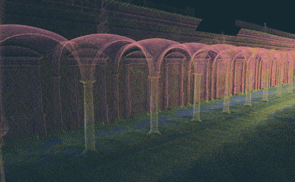
Arcade structure captured with a SLAM LiDAR scanner and processed in 3Dsurvey.
Conclusion
Choosing between RTK videogrammetry and SLAMLiDAR comes down to your environment and budget.
Use RTK videogrammetry for outdoor trenches, utility installations, and building facades where lighting is decent and satellite signals are available. Choose SLAM when you are working indoors, in tunnels, or anywhere GNSS is unreliable.
It is worth noting that SLAM can handle most of what videogrammetry does, including outdoor linear sites. However, the hardware costs significantly more.
Neither tool does everything, but together they cover most ground-level scenarios where drones are not an option.
If you want to test how your data processes, 3Dsurvey offers a 14-day free trial. You can also get both modules (Scan and RTK Videogrammetry) as add-ons for a monthly subscription and only opt-in when you actually need the tools.