People often search ‘what is point cloud’ when they first get into photogrammetry, so we decided to provide an answer for you.
What is a point cloud? If you’ve ever tried to figure that out, you’ve probably come across one of two explanations:
- A dry, technical definition full of geometry terms, or
- Some vague analogy like “it’s a 3D dot-to-dot drawing” (thanks, Google).
Let’s do better than that.
Whether you’re just starting out in surveying, working with drone photogrammetry, or managing 3D data in construction or mining, getting your head around point cloud data is a key step. And at 3Dsurvey, this is the stuff we work with every day – in real projects, with real terrain, and real deadlines.
So… what is a point cloud?
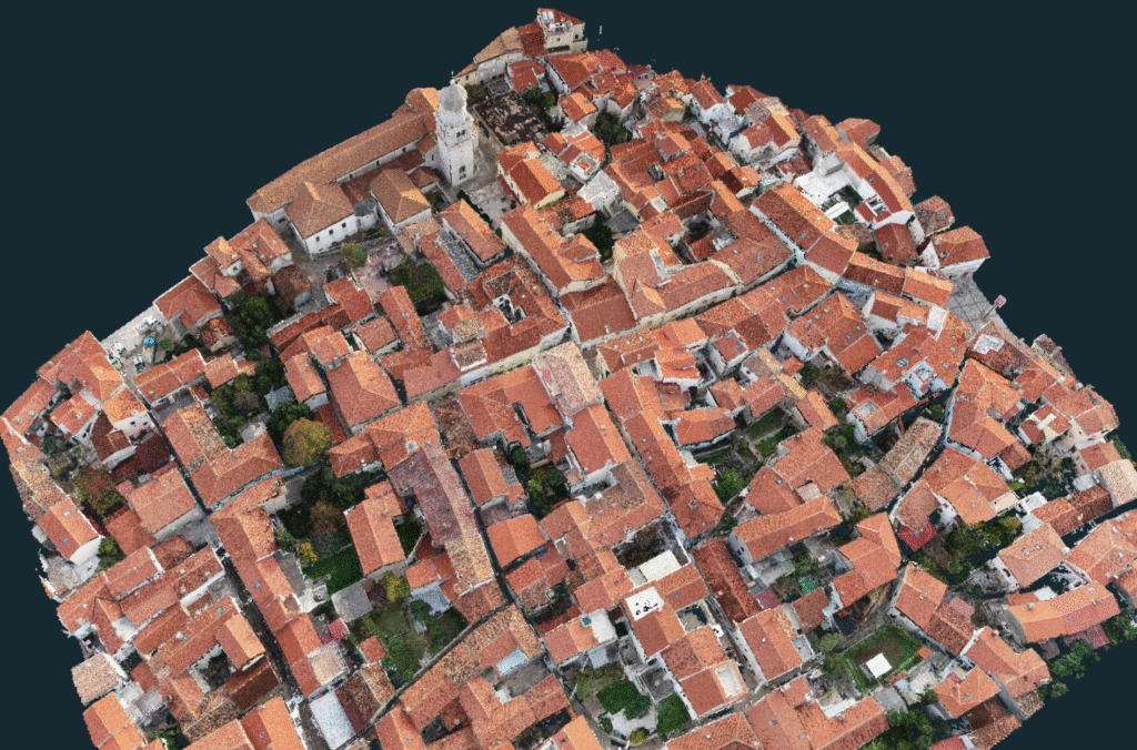
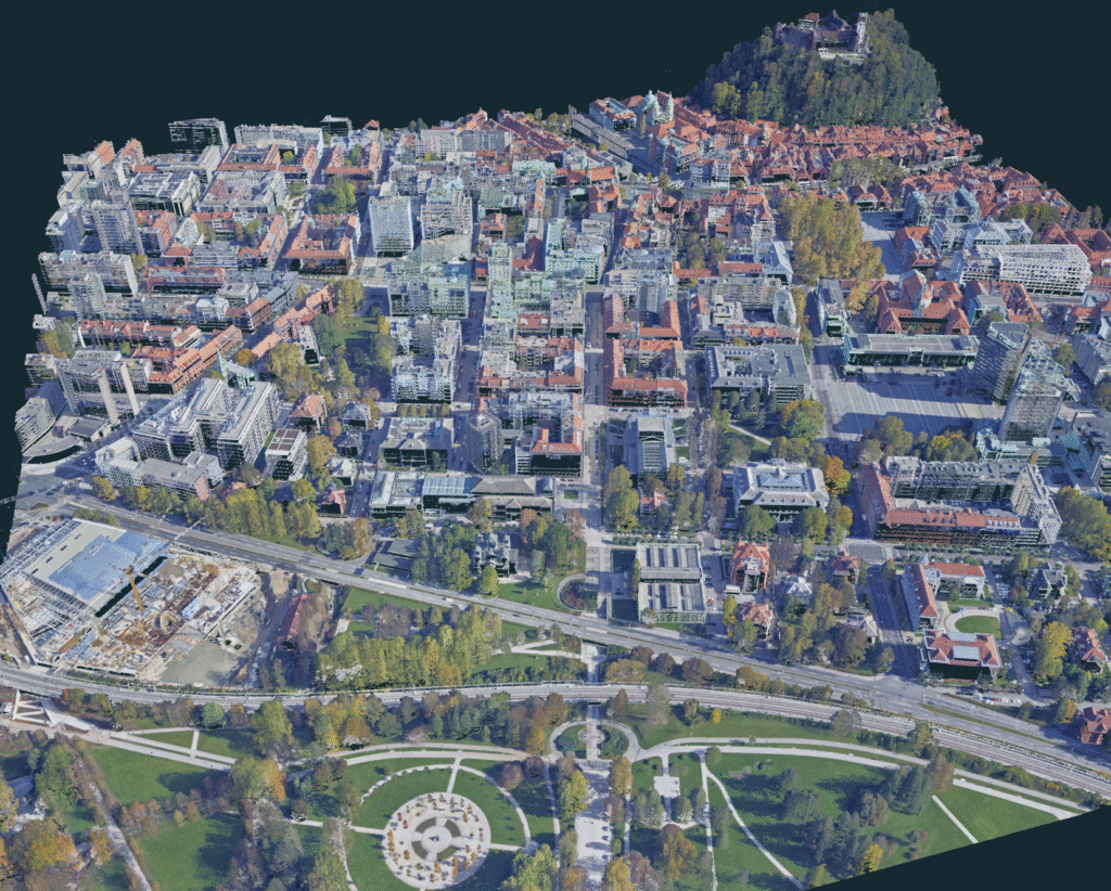
At its core, a point cloud is a big collection of tiny points in 3D space. Each point has an exact location – X, Y, and Z – and it represents a real spot on a real surface. That could be the ground, a wall, a roof, a tree, a rock, a truck… basically anything.
You generate these points using photogrammetry (by taking overlapping photos) or LiDAR (with laser scanning). Once you put all those points together, you get a 3D version of reality or as also known as a Digital Twin, which is incredibly detailed, measurable, and way more useful than any photo.
And while the idea sounds raw or rough, 3Dsurvey’s point clouds are known for being some of the cleanest and densest out there. We’ve spent years making sure that what you see is something you can actually use, not just look at.
What makes point cloud data so useful?
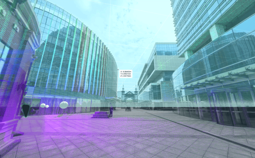
The magic of point clouds is that they aren’t just visuals, they’re data. You can measure from them, analyze them, model from them. They’re georeferenced, detailed, and packed with real-world structure.
Here’s why they’re so powerful:
- Accuracy: You get precision down to the centimetre or millimetre.
- Scalability: Whether you’re mapping a construction trench or an entire quarry, the workflow stays efficient.
- Flexibility: you can calculate profiles and/or vectorise edges
- Foundation for everything: Orthophotos, surface models, Mesh, CAD drawings, contour lines and volumes – they all start with the point cloud.
If you’re working with physical space in any form, this is your raw material. You can also read our blog on 3 reasons you need a point cloud software, if you want to dive deeper into this.
Photogrammetry vs. LiDAR: different roads to the “same” point cloud
There are two most common ways to generate a 3D point cloud in land surveying and mapping:
- Photogrammetry: using overlapping images from drones or ground cameras and turning them into 3D points via triangulation. Tools like 3Dsurvey handle this with ease and deliver detailed, dense clouds.
- LiDAR: where a sensor shoots laser pulses and measures how long they take to bounce back. This is especially useful under tree canopies, along power lines, or in tight corridors.
These two cover the vast majority of field use cases, especially for outdoor mapping. Other methods, like structured light, SLAM, or sonar, also produce point clouds, but are typically used in smaller-scale, indoor, or underwater projects.
Both above mentioned methods are widely used, and with 3Dsurvey, you’re not forced to choose one. You can work with either, or even better, combine them. You can import LiDAR or SLAM point clouds, align them with photogrammetry outputs, and analyze both together in one project.
Example of combining different point clouds can be seen in this case study, where we combined even photogrammetry with bathymetry!
And if you’re working with LiDAR scanners that also capture 360° panoramic images, 3Dsurvey has you covered there too. You can import those visuals and navigate through your project visually while interacting with the point cloud itself.
What can you do with a 3D point cloud in 3Dsurvey?
This is where things get real. 3Dsurvey doesn’t treat your point cloud as something static or locked-in. You actually get to work with it.
Here’s what our users regularly do:
- Build digital terrain and surface models (click for a real world example).
- Create high-resolution orthophotos.
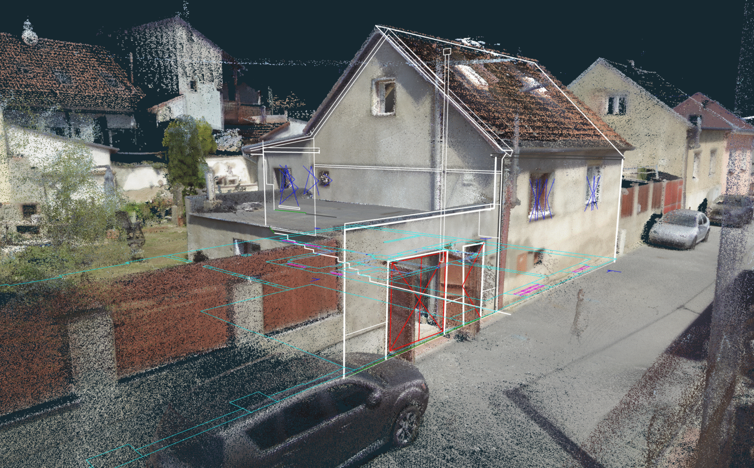
- Draw CAD lines and breaklines directly on the cloud. See how our users are using CAD.
- Calculate volumes (cut/fill, stockpiles, earthworks), from a point cloud produced DTM. Great example can be found on the link.
- Produce accurate building floorplans.
- Explore 360° images in sync with spatial data for better site context.
You can go from “raw” data to deliverables – measurements, models, visuals – in hours, not days.
Not all point clouds play nice with traditional CAD software and that’s OK
Here’s something many beginners learn the hard way: throwing an entire dense point cloud into a CAD tool often causes problems. It can slow things down, crash viewports, or just be unusable. CAD software wasn’t built for raw point cloud volume, it prefers clean linework and simplified surfaces. But 3Dsurvey was, because it was hard to bring point cloud into CAD software, we made it possible to bring CAD tools to point cloud, within 3Dsurvey of course. That’s why in 3Dsurvey, you clean, classify, and draw CAD-ready geometry directly on the cloud, before you export. If you are interested in finding out more details, check out our webinar on getting data ready for the CAD.
You’re not exporting 200 million points, you’re exporting only the exact breaklines, surfaces, or contours you need. That way, CAD users get a streamlined file that’s lightweight, precise, and ready for work.
You can read more about on how to master CAD tools in this blog.
Why 3Dsurvey’s point cloud stands out?
Let’s be honest, not all point clouds are nice to work with. Some are noisy, patchy, or full of irrelevant details. That’s why there’s 3Dsurvey, a powerful tool that lets you:
- classify and filter points,
- remove noise and outliers,
- clean up your point cloud,
- perform uniform point reduction and finally
- export your results.
That’s why so many professionals stick with 3Dsurvey once they try it. More on point cloud classification you can find in our blog.
Why beginners love it and why experts stick around?
For beginners, 3Dsurvey is straightforward. You can:
- import drone images,
- generate a point cloud,
- and start drawing or measuring, without needing a PhD in geospatial science.
For seasoned surveyors, there’s plenty of power under the hood as well:
- global coordinate system coverage and support
- unlimited project growth (add as many surveys as you like)
- merging and managing complex projects
- unmatched integrated CAD engine with tools from surveyors for surveyors and
- unlimited point clouds opened at the same time
You can work fast, stay precise, and avoid the bloat that slows down other software.
Final thought: What is a point cloud?
A point cloud isn’t the final product. It’s the launchpad, that gives you a detailed, measurable version of reality. From there you can create whatever you need.
Whether you’re planning, building, documenting, or analysing point cloud data lets you make better decisions with less guesswork.
And with 3Dsurvey, that process is more practical, less painful. Download 3Dsurvey and build your first point cloud from drone images, LiDAR, or both. You’ll be surprised how quickly you go from scanning to delivering real, useful results.

