Watch the webinar recording to learn all about the latest update:
1. 3Dsurvey Cloud
Viewer and project management tool
3Dsurvey is dedicated to innovation and revolutionizing the processing and utilization of spatial data for everyone. Allow us to introduce 3Dsurvey Cloud! We are thrilled to offer our users this exceptional new tool, designed to revolutionize the way you organize and showcase your work.
3Dsurvey Cloud is a groundbreaking platform designed to make your drone surveying tasks more accessible, efficient, and collaborative. It allows users to easily share 3Dsurvey results with clients and effectively manage their projects. 3Dsurvey Cloud represents a significant leap forward in how survey data is processed, managed, and shared.
Cloud Viewer
Cloud platform seamlessly integrated into 3Dsurvey enables you fast and effortless project sharing with non 3Dsurvey users. No more trouble sharing large projects via external providers like WeTransfer or Google Drive. And no need for recipients to install a viewer or worry about having a high performance computer.
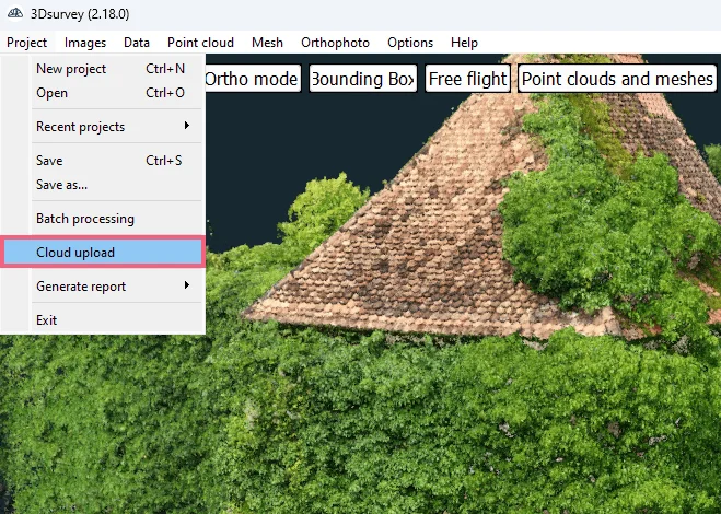
Upload directly to Cloud
After this update, you will be able to save your work in the Cloud and share it with just a few clicks. Process your data in 3Dsurvey, as usual, then effortlessly upload results directly to the Cloud, including Point Clouds, Meshes, Orthophotos, and CAD data.
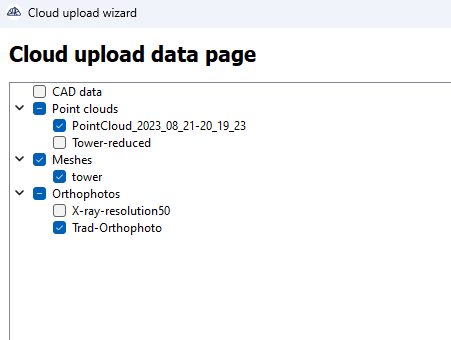
Select the data
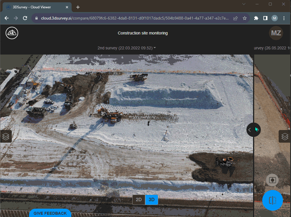
Organize your projects, and include different surveys of the same site under one project to showcase its progress. Compare measurements side by side using the “before & after” view.
Compare two survey datasets
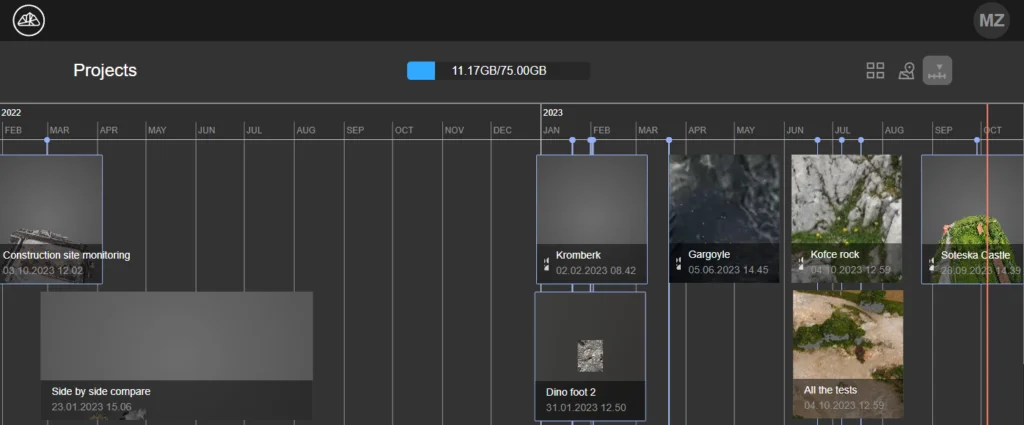
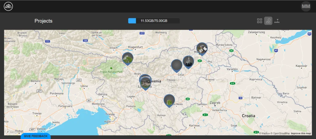
Your projects can be presented in a timeline or map view. This sort of cataloging simplifies the process of tracking the spatial and temporal order of your projects.
Timeline view
Map view
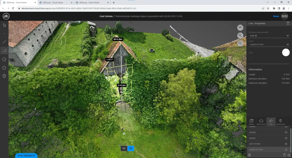
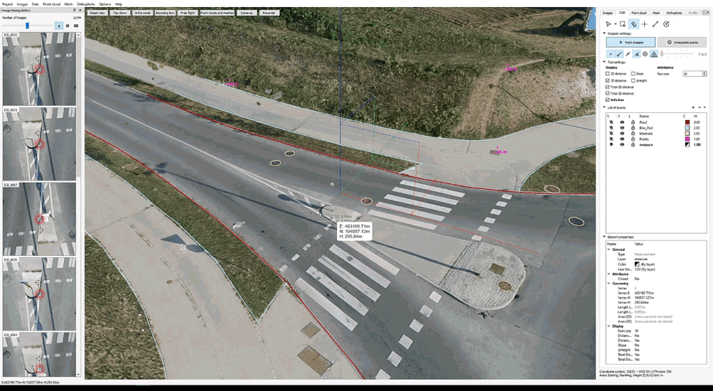
The Cloud Viewer offers a range of useful drawing and measuring tools, including:
Distance Measurement: Precisely measure distances in both 2D and 3D.
Area Measurement: Calculate areas in 2D and 3D.
Point tool: Add points with coordinates
Height Difference Measurement: Monitor changes in elevation.
Annotation Tools: Add informative annotations to your data.
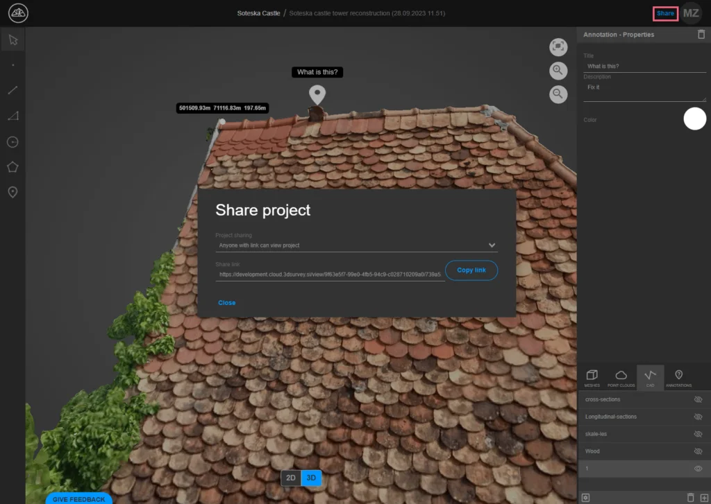
These tools can be used by you or by anyone you share your project with. To share your project simply click the “Share” button in the top right corner and copy the generated link.
Share the link
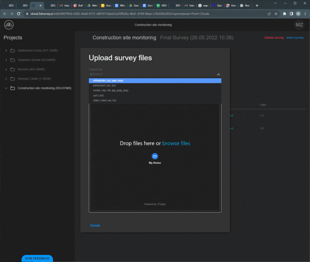
Uploading directly from 3Dsurvey is not the only option. The web browser Cloud platform also supports adding new surveys or projects directly through its interface.
Upload via web browser
3Dsurvey Cloud supports the following formats:
For point cloud: LAS
For Mesh: OBJ
For Orthophoto: PNG with geolocation file (PGW)
CAD data: DXF
A perfect addition to the 3Dsurvey workflow, making your job even easier and your clients happier.
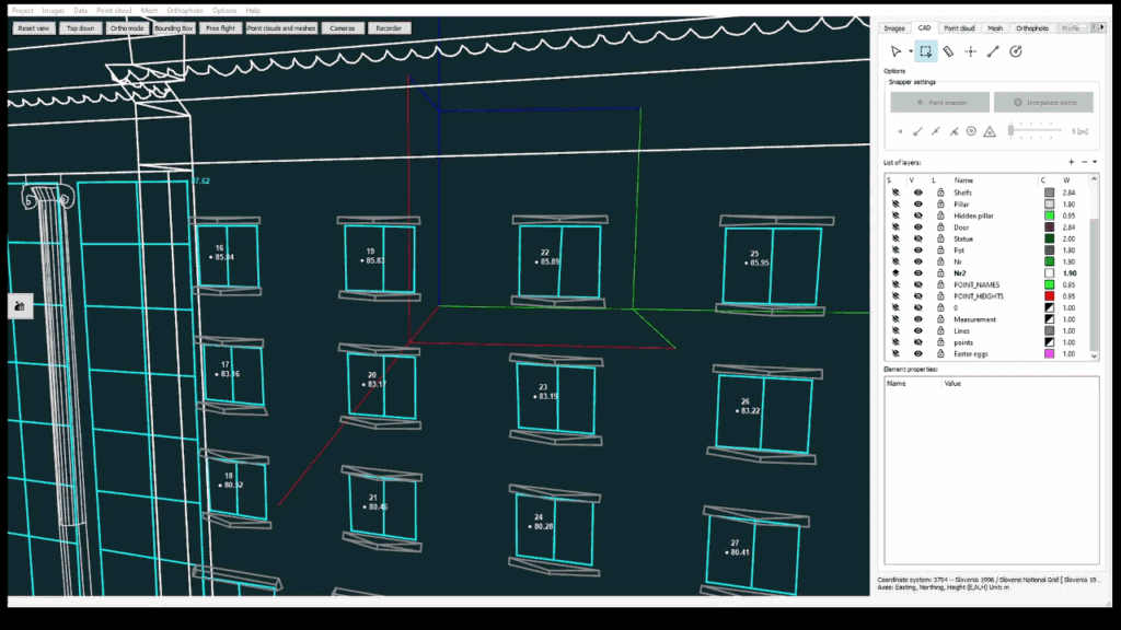
2. CAD module upgrade
The CAD module is a vital component of 3Dsurvey, and we are committed to continuous enhancement and refinement to make the tools more intuitive and your experience more enhanced. This version introduces several minor, yet valuable improvements:
add CAD elements to selection by holding down CTRL. Allowing to add various data types and layers into selection.
Using CTRL to add multiple elements
sub-windows in the working panel are now collapsable
Collapsable sub-windows
the coordinate info box on the pointer can now be turned off.
White coordinate info box disabled
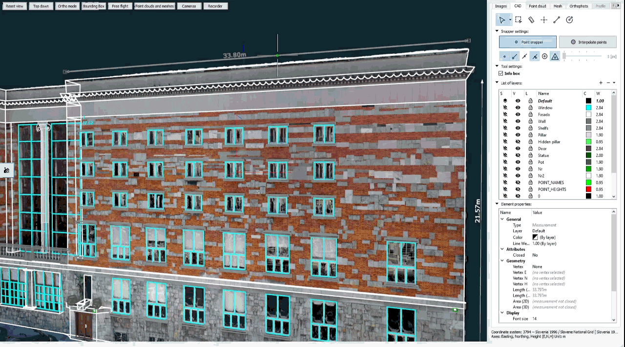
the total length of the measurement is calculated and displayed automatically
Total length measured
Benefits:
Closer to native AutoCAD experience, more customizable and user friendly.
Use cases:
Quick way to measure the total length of curved road curb
When working with numerous layers, you can now collapse other sub-windows to see all the layers (so you don’t have to scroll through them)
Someone sent you a CAD file with no layer and now you have to pick your points / lines one by one? That’s now possible.
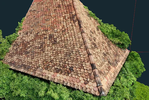
3. Texture improvement
We have been improving our algorithm to bring you the highest resolution possible. Optimal images are selected to generate the texture, ensuring the highest resolution, making the end result look better than ever before.
Super hi-res texture will bring your 3D models to life
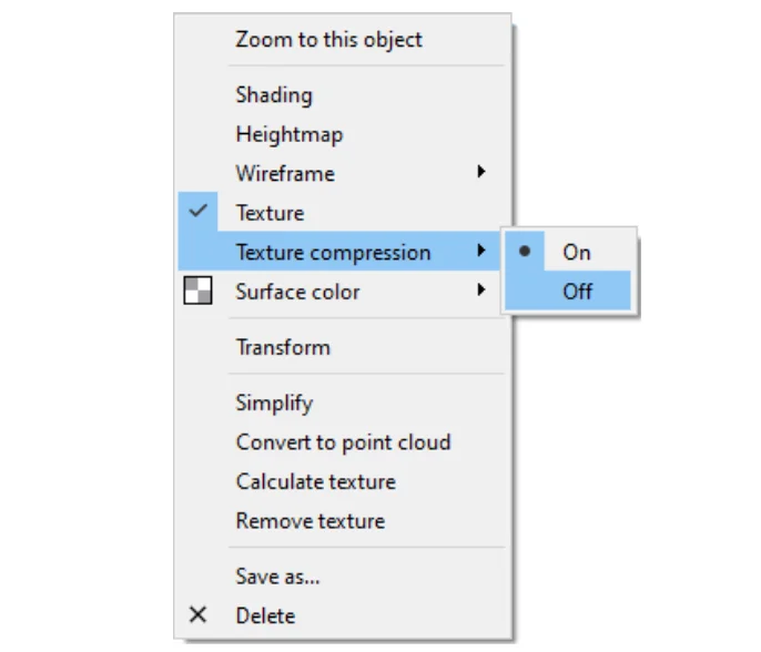
This update may cause higher memory usage, so we’ve also implemented texture compression. With the compression, loading up a texture takes 6-times less memory. Another aspect we wanted to improve is the waiting time when the texture first loads. As a result, we simply eliminated the need to wait. Now while the texture is loading, you are free to view, rotate and even draw on your model.
Every textured 3D mesh now has a new option in the right-click context menu, where you can toggle the texture compression On and Off.
Activate / deactivate the texture compression in the right-click context menu
4. Snapshot functionality upgrade
You asked, and we delivered! Pressing “c” now generates images without the coordinate center cross on it, giving you perfect snapshots of your project without any unwanted elements. The flash animation appears to remind the user of the action taken. We added the flash animation to make this feature more intuitive and user-friendly.
Flash animation and center cross removed
5. LandXML support
For all AutoCAD & BIM users, LandXML files are now supported. You are no longer limited to raster data or additional steps to integrate your design surface from your CAD or BIM software into 3Dsurvey. Simply export as LandXML and import as mesh.
Design surfaces (DSM) can now also be imported by LandXML, which is a more convenient format than GeoTiff due to it being a structured vector data format. Use it to compare actual terrain to design surfaces or calculate volumes between current and design surfaces.
As LandXML also integrates with BIM, you can now also export a BIM model into 3Dsurvey software. We are committed to bringing you more integration and compatibility.
Exporting as LandXML. Importing as DSM
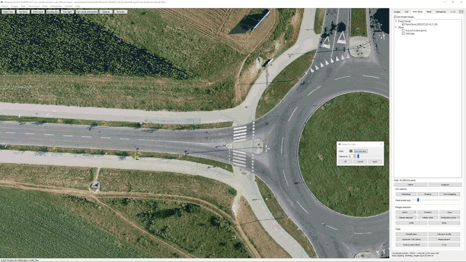
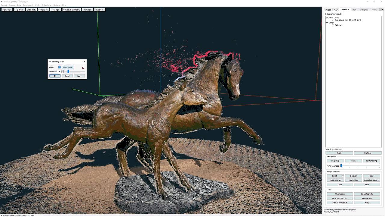
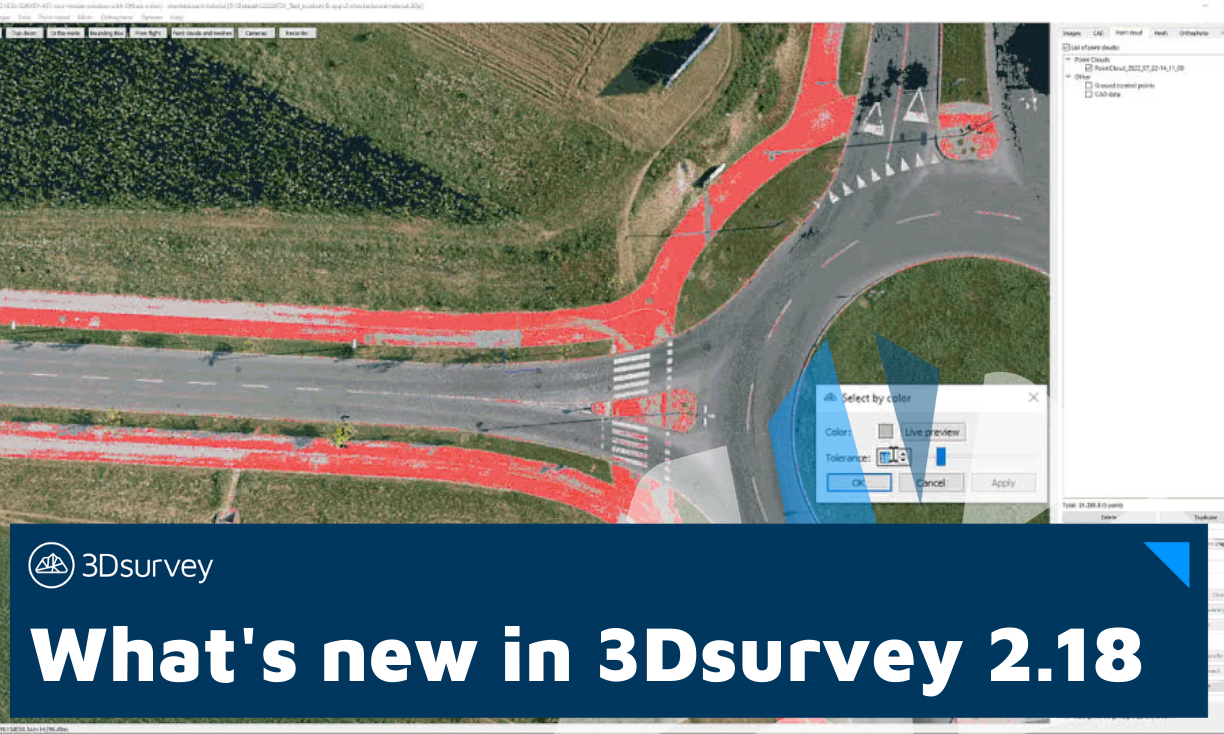
6. Select by color
This feature was designed to assist you in editing your point cloud. It allows you to easily remove the noise, making your 3D model cleaner, more realistic and true to form.
Select the portion of the point cloud based on color value, adjusted by tolerance slider. Choose a point of a certain color and this new feature will select all points of a similar color shade. Tolerance is defined by a slider and a preview is rendered in real time.
Select color and adjust tolerance
Selection can be restricted with the bounding box tool if desired. Eyedropper functionality has been developed for this feature to allow for easy selection.
This feature is great for cleaning the point cloud of potential unwanted colors.
How many times have you got the green of the trees onto your object, or blue sky shades on a roof edge? This tool makes cleaning of that kind of noise a trivial task.
Cleaning the point cloud
This feature also allows for quick selection and classification of areas across the point cloud that belong to a certain color shade.
Select color, preview and filter
Need to select just the orange roof tops, deep blue solar panels, gray asphalt or green grass? Especially when these surfaces are disjointed, of odd shapes and scattered all over your point cloud, this would be a daunting task to do by hand. With the Select by color feature it only takes a few clicks.
We’re helping you create more accurate 3D models and true orthophotos.
7. Ortophoto handling optimization
We’ve optimized exporting your orthophotos to help you save storage space and lessen the load of your active memory.
Tiled TIFF support: The advantage of the tiled format is that extremely large images can be loaded and displayed efficiently. No large image will ever clog your memory again.
Compression update: TIFF compression was implemented to save your storage space, making your orthophoto size smaller than before, while not compromising image quality.
PNG compression: Faster image writing. Same quality in half the processing time.
Minor improvements
Right click on the project in the viewer, welcome screen will offer you to open project location or remove the project from the list
Reduce point cloud is now also available in the context menu when right-clicking the desired point cloud in the working panel.
What’s fixed
CAD default layer set to active layer: When using Generate CAD points functionality, the points generated will automatically get assigned to the current active layer.
Select texture resolution bug fixed
Corrupted .png export resolved. (Certain third party software weren’t able to read .png files before)
Version 2.18 is available to all existing users with an active 3Dsurvey Yearly Support & Upgrades extension or Subscription.