

Geodetic plans for railway and road
Overview
Unmanned aircraft vehicles (UAVs) are ideal data gathering tools for longitudinal works such as roads, highways, or railways due to their efficiency, cost-effectiveness, accessibility, flexibility, accuracy, and ability to provide real-time data. They can cover large areas quickly and economically, accessing remote or hazardous locations that are challenging for ground-based surveys.
Equipped with various sensors, including cameras and LiDAR, UAVs can collect high-resolution data for mapping, asset inventory, and infrastructure monitoring with precision. Their capability to transmit data in real-time enables project managers to swiftly assess project status and address potential issues, making UAVs indispensable assets for longitudinal projects.
Geodetic plan for Railway
A geodetic plan for a railway created using a drone involves meticulously planning the flight path and capturing high-resolution data along the railway corridor. GPS ensures precise geo-referencing of collected data points. After processing the captured imagery to generate orthophotos, point clouds, and 3D models, thorough analysis identifies track alignment, elevation profiles, and infrastructure conditions.
The resulting geodetic plan encompasses detailed mapping of the railway corridor, including property boundaries and relevant coordinates, compiled into a comprehensive document adhering to industry standards. This streamlined approach to data collection and mapping, facilitated by drones, offers unparalleled accuracy and efficiency for railway planning, construction, and maintenance endeavors.
For our project, we carried out the measurements for the geodetical plan and the plan for project of works executed in the vicinity of Postojna, Slovenia.
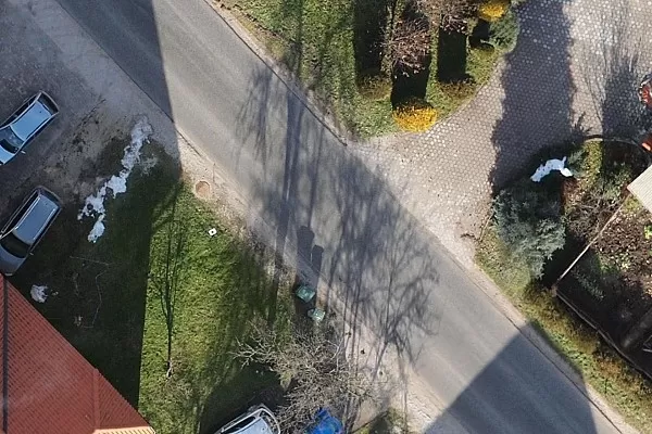
3Dsurvey Outputs for Railway near Postojna


Geodetic plan for Road
Creating a geodetic plan for a road utilizing a drone involves meticulous planning, precise execution, and thorough data processing. The drone is deployed equipped with high-resolution cameras and GPS to capture detailed imagery and accurately geo-reference data points.
Flight paths are strategically designed to cover the entire length of the road, ensuring comprehensive coverage of the corridor and surrounding terrain. Post-flight data processing involves stitching together the captured images, generating orthophotos, and creating digital elevation models to analyze road alignment, gradient variations, and surrounding features.
The resulting geodetic plan provides invaluable information for road design, maintenance, and management, facilitating informed decision-making and ensuring the efficient and safe operation of transportation infrastructure.
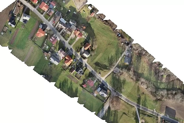
For our project, we devised a 3D geodetic plan for 1.7 km in length road reconstruction with the help of photogrammetric and tachometric measurements. We created a detailed orthophoto map with 2-centimetre resolution, and a detailed digital terrain model, along with a 3D geodetic plan. These serve as a basis for planning and provide project leaders with excellent support.
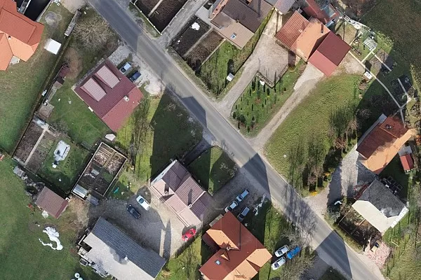
3Dsurvey Outputs for 1.7km Road
Keen to try 3Dsurvey for yourself? Try it free for 14 days!